
Directional Boring Contractors in Clay County, TX
Trinity Boring Solutions is a directional boring contractor serving Clay County, Texas, installing water, sewer, gas, electric and fiber lines without an open trench in Henrietta, Petrolia, Dean, Byers, Bellevue and Jolly. The Trinity main office in Yukon, Oklahoma is about 163 road miles from Henrietta, the county seat. Bores here most often pass under US 287 and US 82, the Little Wichita River and BNSF Railway track. Call (405) 409-7423 any time.
Free Bore Planner
Plan Your Bore in Clay County, Texas
Type the address of your job in Clay County. The Bore Planner opens an aerial map at that spot. Drop one pin where the bore starts and one where it ends, tell us what is going in and send the scope to our crew.
What Should You Know Before Boring in Clay County?
Clay County covers 1,089 square miles, has about 10,730 residents and sits in the TxDOT Wichita Falls District.
| County seat | Henrietta |
|---|---|
| Population | 10,730 (2024 Census estimate), up 5.0% since 2020 |
| Land area | 1,089 square miles |
| Largest cities and towns | Henrietta (3,237), Petrolia (537), Dean (521), Byers (475) and Bellevue (298) |
| TxDOT district | TxDOT Wichita Falls District |
| 811 center | Texas811 (call 811), two working days of notice |
| Electric utilities | Oncor Electric Delivery Company, Texas-New Mexico Power and Wise Electric Cooperative |
| Interstate and US highways | US 287 and US 82 |
| State Highways | 79 and 148 |
| State loops and spurs | Spur 47 |
| Rivers | Little Wichita River, East Fork Little Wichita River, Wichita River and Dry Fork Little Wichita River |
| Creeks and other streams | Turkey Creek, Smith Creek, Long Creek, Duck Creek, Deer Creek, East Post Oak Creek, Bennett Creek and Buffalo Creek |
| Lakes | Lake Arrowhead |
| Railroads | BNSF Railway, about 33 main line miles |
| Average precipitation | 32.5 inches a year (1991 to 2020) |
| New housing units permitted | 8 in 2025 |
| Road distance from Trinity main office | About 163 miles from Yukon, Oklahoma to Henrietta |
| Trinity insurance | General liability of $1,000,000 per occurrence and $4,000,000 aggregate, plus $5,000,000 excess liability |
Sources: Census Bureau (2024 population, 2025 building permits, TIGER/Line roads and water), EIA Form 861 (2025), NOAA 1991 to 2020 precipitation, federal rail network map, TxDOT districts, OpenStreetMap routing. Checked November 2026.
What Does a Bore Have to Cross in Clay County?
A bore in Clay County most often has to cross a highway such as US 287, US 82 or State Highway 148, a stream such as the Little Wichita River, the East Fork Little Wichita River or Turkey Creek and BNSF Railway track. State Highways 79 and 148 also run through the county, along with Spur 47. The Census map names 25 larger streams in Clay County, led by the Little Wichita River, the East Fork Little Wichita River, the Wichita River, Turkey Creek, Smith Creek and the Dry Fork Little Wichita River. The rest are Long Creek, Duck Creek, Deer Creek, East Post Oak Creek, Bennett Creek, Buffalo Creek, Russell Creek, Hay Creek, Big Sandy Creek, Lodge Creek, Prairie Branch, Jones Creek, Joy Creek, Lake Creek, Willow Creek, Flat Creek, West Belknap Creek, Beaver Creek and East Little Post Oak Creek. Lake Arrowhead is the main mapped lake. The federal rail map shows about 33 miles of main line track in Clay County, owned by BNSF Railway.
What Is the Ground Like for Directional Boring in Clay County?
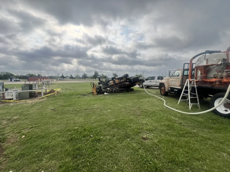
Clay is the main thing to plan for in Clay County: the federal soil survey records a clay rich layer in the top five feet on about 58 percent of the county and bedrock within five feet on about 34 percent. For Clay County clay the drilling fluid is mixed to stop the cuttings from balling up behind the reamer. May is the wettest month in Clay County at 4.5 inches on average and January the driest at 1.5. Clay County averages 32.5 inches of precipitation a year, so rain delays are occasional.
- Most common soils: Bluegrove (10%), Kamay (9%) and Stoneburg (7%).
- Surface texture: most often loam (33%) or silt loam (23%).
- Bedrock within 5 feet: about 34% of the county. Most of it is soft, weathered rock.
- Clay rich layer (35% clay or more) in the top 5 feet: about 58% of the county.
- Sandy layer (70% sand or more) in the top 5 feet: about 6% of the county.
Source: USDA Natural Resources Conservation Service, Soil Survey Geographic Database, Clay County, Texas (survey area TX077, version 23, September 3, 2026), through Web Soil Survey. Percentages are shares of mapped county area.
Who Permits a Bore in Clay County?
The TxDOT Wichita Falls District permits bores under state highways in Clay County, the Clay County Commissioners Court handles county roads, and Henrietta, Petrolia and Dean each handle their own streets.
- State highways. US 287, US 82, the other numbered state routes and the farm to market roads in Clay County are on the state system. The utility owner files a TxDOT utility permit in RULIS.
- Texas811 locates. Texas811 needs at least two working days of notice before digging (Texas811 FAQ; Texas Utilities Code, Section 251.151).
- Railroads. A bore under BNSF Railway track in Clay County needs a crossing agreement from the railroad that owns it, which sets the casing, depth and flagging.
- Water crossings. A bore under the Little Wichita River, the East Fork Little Wichita River, Turkey Creek or Lake Arrowhead is checked for U.S. Army Corps of Engineers jurisdiction while the path is planned.
Statewide rules are on the Directional Boring Texas page, and Trinity supplies the bore plan and profile for the permit package.
Which Electric Utilities Serve Clay County?
Oncor Electric Delivery Company, Texas-New Mexico Power and Wise Electric Cooperative serve Clay County, according to 2025 filings with the U.S. Energy Information Administration. Oncor Electric Delivery Company and Texas-New Mexico Power are investor owned utilities; Wise Electric Cooperative is a member owned cooperative. Conduit bored in Clay County is built to the standard of whichever of them owns the line. More on electric line boring for electric cooperatives.
How Much New Construction Is There in Clay County?
Clay County permitted 8 new housing units in 2025, 4 of them single family homes, according to the Census Bureau Building Permits Survey. The population of Clay County went from 10,217 in 2020 to 10,730 in 2024, a gain of 5.0 percent. Bore work in Clay County is a mix of new services and replacement of older lines.
Which Cities and Towns in Clay County Does Trinity Serve?
Trinity takes directional boring work in all 8 incorporated places in Clay County and at sites outside city limits, and Henrietta is the largest with about 3,237 residents.
| City or town | 2024 population |
|---|---|
| Henrietta | 3,237 |
| Petrolia | 537 |
| Dean | 521 |
| Byers | 475 |
| Bellevue | 298 |
| Jolly | 180 |
| Windthorst | 13 |
| Wichita Falls | 1 |
Source: U.S. Census Bureau 2024 estimates, counting only the part of each city inside Clay County.
Clay County borders Archer County, Jack County, Montague County, Wichita County, Cotton County, Oklahoma and Jefferson County, Oklahoma; every county is on the Directional Boring in All 254 Texas Counties page. The neighboring county seats are Archer City (Archer), Jacksboro (Jack), Montague (Montague) and Wichita Falls (Wichita).
Which Directional Boring Services Are Available in Clay County?
Every Trinity service is available in Clay County: horizontal directional drilling from 3/4 inch service lines to 48 inch casing, auger boring, hydrovac potholing, trenching and 24 hour emergency response, all listed under Underground Utility and Boring Services.
- Road, highway, railroad, creek and river bore crossings, including US 287, US 82 and the Little Wichita River
- Bores under BNSF Railway track, built to the railroad boring requirements of the owner
- Drinkable water line boring and sewer force mains in Henrietta or Petrolia and on rural water systems
- Underground conduit in Oncor Electric Delivery Company and Texas-New Mexico Power territory, see electric line boring
- Fiber optic boring for ISPs and broadband builders along US 287
- Municipal boring services for cities such as Henrietta, Petrolia and Dean
The free Bore Planner sizes a Clay County job before you call.
Clay County Directional Boring FAQs: What Do Customers Ask?
Does Trinity Boring Solutions work in Henrietta, Texas?
Yes. Trinity Boring Solutions takes work in Henrietta, Petrolia, Dean, Byers, Bellevue and Jolly and the rural parts of Clay County. Trinity works in Texas with its own crews and from satellite yards run by partner drilling contractors Trinity has personally vetted.
Who approves a bore under US 287 in Clay County?
The TxDOT Wichita Falls District. The utility owner files the permit in the TxDOT RULIS system. County roads go through the Clay County Commissioners Court and city streets through the city.
Is there rock in Clay County?
Yes, in places. The federal soil survey records bedrock within five feet of the surface on about 34 percent of Clay County, most of it soft, weathered rock. Potholing confirms it on the actual bore path.
Can a line be bored under the Little Wichita River in Clay County?
Yes. A drill is steered below the bed of the Little Wichita River from a pit on each bank and the pipe is pulled back through, so the channel is not opened. Federal jurisdiction over the crossing is checked first.
Which railroads have track in Clay County?
BNSF Railway, with about 33 miles of main line track on the federal rail map. Each requires its own crossing agreement before a bore goes under the rails.
Is Trinity insured for work in Clay County?
Yes. Trinity Boring Solutions carries general liability of $1,000,000 per occurrence and $4,000,000 aggregate, plus $5,000,000 excess liability. Ask for a certificate with the quote.
How much does directional boring cost in Clay County?
Footage and pipe size set a general range. Depth, the crossings and the ground set the number, and heavy clay is a factor on many Clay County jobs.
How Do You Get a Bore Quote in Clay County?
Call (405) 409-7423 any time or send the address in Clay County, the utility, the length and what it crosses. Trinity has bored since 1965 and is family owned.