
Directional Boring Contractors in Texas
Trinity Boring Solutions is a licensed and insured directional boring company serving all of Texas, from the DFW metroplex and the I-35 corridor to Houston, the Coastal Bend, East Texas, the Permian Basin and the Panhandle. Horizontal directional drilling, auger boring with steel casing, hydrovac potholing and trenching for water, sewer, gas, electric and fiber, with crews and owned Vermeer and Ditch Witch rigs mobilizing from Yukon, Oklahoma. Call (405) 409-7423 for a written quote anywhere in Texas.
Quick Answer: Directional boring in Texas installs water, sewer, gas, electric and fiber lines under highways, streets, driveways and landscaping without open cuts. Trinity Boring Solutions serves every Texas county from its Oklahoma City metro base, files the Texas811 ticket and handles TxDOT district permits. Call (405) 409-7423.
Directional boring in Texas, answered in one paragraph. Trinity Boring Solutions is a family owned horizontal directional drilling contractor based in the Oklahoma City metro since 1965. We install water, sewer, natural gas, electric and fiber lines under roads, driveways, parking lots, creeks and existing utilities across Texas, from DFW and Austin to Houston, San Antonio, El Paso and the Panhandle, with one crew handling Texas811 locates, hydrovac potholing, the bore, pullback and pit restoration. Call (405) 409-7423, answered 24 hours a day.
Trinity Boring Solutions at a glance
- Serves all of Texas. Crews and rigs mobilize from the Oklahoma City metro. Every Texas county sits inside a service area that also covers all 77 Oklahoma counties.
- Since 1965. Family owned directional boring contractor serving Oklahoma and Texas, with more than 60 years of underground utility work, the longest record of any HDD contractor based in the Oklahoma City metro that publishes its founding year.
- Oklahoma City metro based. Headquartered at 9102 NW Expressway in Yukon, Oklahoma. Crews and rigs mobilize from the Oklahoma City metro for Texas work.
- Owns its equipment. Vermeer and Ditch Witch HDD rigs, auger boring machines and hydrovac trucks, all owned outright and run by Trinity operators.
- One crew, whole job. 811 locates and hydrovac potholing, horizontal directional drilling, auger boring with steel casing, trenching, backfill and pit restoration from the same company, so there is no handoff between a locator, a driller and an excavator.
- Range. 3/4 inch service lines to 48 inch casing, 10 feet to 5,000 feet, for water, sewer, natural gas and propane, electric and fiber.
- Named work. 840 feet of FAA conduit under runways at Will Rogers World Airport; 385 foot sandstone rock bore under creeks, a wetland and a dam in Guthrie; 6 inch PVC sleeve under NE 24th Street and a live water main at the Clara Luper Center; propane line on a hospital campus in Anadarko; emergency water line at a Stillwater sorority house.
- Pricing. No per foot rate. A bore is priced on its conditions: soil and rock, pipe size, what it crosses, grade, existing utilities, depth and access. How a bore is priced.
- Safety record. 25 years without a utility strike, with Texas811 tickets and hydrovac potholing on every crossing.
- 24 hour phone. (405) 409-7423 is answered around the clock, with emergency crews for gas and water lines.
Where in Texas Do You Need a Bore? Tap Your County.
Trinity Boring Solutions takes directional boring work in all 254 Texas counties. Tap a county to see its county seat, its population and the cities we serve there. The brighter counties have a Trinity city page. Need a bore in Oklahoma? See the Oklahoma county map.
Pick a County in Texas
Tap the map or use the list. Each county shows its county seat, its population and its cities and towns.
- 254 counties
- 1,609 cities and towns on this map
- 31.3M residents, 2024 Census estimate
- 29 Trinity city pages linked
Population figures are U.S. Census Bureau 2024 estimates.
Free Bore Planner
Plan Your Bore in Texas
Type the address of your job in Texas. The Bore Planner opens an aerial map at that spot. Drop one pin where the bore starts and one where it ends, tell us what is going in and send the scope to our crew.
Directional Boring Across Texas
Texas is the largest utility construction market in the country, and nearly every project in it eventually needs a line across something that cannot be cut: a TxDOT highway, a city street, a finished driveway, a creek, a rail line or a live utility corridor. Horizontal directional drilling puts water, sewer, gas, electric and fiber under those obstacles from two small pits. Trinity Boring Solutions has done that work since 1965 and brings the same owned rigs, operators and one crew process to every Texas city it serves.
Trinity does not publish a per foot rate for Texas work because soil changes more across this state than almost anywhere else. Expansive Blackland clay across DFW and the I-35 corridor, limestone and caliche around Austin, San Antonio and the Permian Basin, sandy clay in East Texas and coastal clay with a shallow water table around Houston and Corpus Christi all drill differently. Each job is reviewed for what is actually under the surface.
Every Texas bore starts with a locate ticket through Texas811 and hydrovac potholing on any utility the path crosses. State highway crossings are permitted through the TxDOT district office for that county, and Trinity prepares the permit package, installs to the permit conditions and provides the closeout documentation.
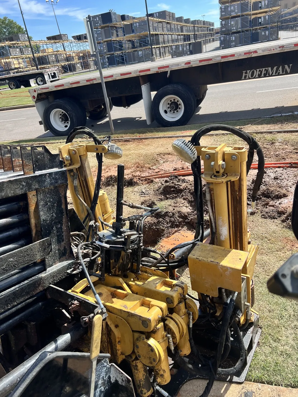
Texas Cities We Serve
Each page below covers the TxDOT district, typical soil, permits and the utilities Trinity installs in that city.
North Texas and DFW
- Directional boring in Dallas, TX
- Directional boring in Fort Worth, TX
- Directional boring in Arlington, TX
- Directional boring in Plano, TX
- Directional boring in Irving, TX
- Directional boring in Garland, TX
- Directional boring in Frisco, TX
- Directional boring in McKinney, TX
- Directional boring in Denton, TX
- Directional boring in Sherman, TX
- Directional boring in Gainesville, TX
- Directional boring in Paris, TX
- Directional boring in Wichita Falls, TX
Central Texas
South and Southeast Texas
East Texas
Texas Boring Services
TxDOT Highway Crossings
Permitted utility crossings under interstate, US and state highway right of way in all 25 TxDOT districts, installed to the permit conditions with closeout documentation.
Water and Sewer Lines
Water service and main installations, sanitary sewer laterals and grade controlled gravity sewer bores for plumbers, builders, cities and utility districts.
Gas and Propane Lines
Natural gas service bores and propane yard lines under driveways, streets and landscaping, with emergency response for damaged or leaking lines.
Electric Conduit and Duct Banks
Primary and secondary electric conduit, multi conduit duct banks, solar and EV charger feeds for commercial sites, developers and electrical contractors.
Fiber and Telecom Conduit
Fiber backbone, drop conduit, innerduct and vault to vault runs for ISPs, telecom general contractors and campus networks statewide.
Auger Boring and Steel Casing
Jack and bore with steel casing for road and railroad crossings where the permit or the engineer calls for a cased crossing instead of open HDD.
What will a directional bore drill through in each Texas county?
Texas has 254 counties, and a bore in Beaumont shares almost nothing with a bore in Kerrville. Everything in this section is taken from the soil survey of the USDA Natural Resources Conservation Service, which is where an engineer starts too. You can read off the leading soil series and soil orders for each county, the material the survey maps around 40 inches (roughly the depth of a utility bore), the part of the county where bedrock or seasonal water sits in the top 5 feet, and how hard the ground is on steel. Click a county name for its own page, which adds the TxDOT district, the permits and the cities. For the full list of 254 counties sorted by TxDOT district, use the Texas locations page.
The Texas underground in ten numbers
- Counties: 254.
- Soil orders: No single order owns Texas. Mollisols lead with 30 percent of mapped acres, Alfisols hold 24 percent and Aridisols 10 percent.
- Soil at bore depth: Around 40 inches, the usual depth of a utility bore, clay is mapped more than anything else (18 percent of acres). Sandy clay loam is next at 14 percent and bedrock third at 12 percent.
- Engineering soil class: On the Unified chart that same depth is CL, lean clay, on 30 percent of acres, CH, fat clay, on 17 percent and SC, clayey sand, on 8 percent.
- Rock: Roughly 26 percent of mapped Texas has bedrock in the top 5 feet, and roughly 22 percent has it in the top 40 inches. Hard bedrock is about 15 percent of the state and soft, weathered bedrock about 11 percent.
- Groundwater: Seasonal high water reaches the top 5 feet under about 11 percent of mapped acres, and the Gulf Coast and deep East Texas hold most of that.
- Flooding: About 8 percent of mapped acres are rated to flood occasionally or frequently.
- Corrosion: Texas is hard on metal. About 48 percent of rated acres are a high corrosion risk for bare steel, and about 14 percent are a high risk for concrete.
- State soil: Houston Black is the Texas state soil. It is mapped in 35 counties, and Collin, Ellis and Travis counties have the largest acreage.
- Most common soil series: Pullman tops the acreage in 11 counties, Amarillo in 9 and Eckrant in 8.
Reading the Texas soil codes like a driller
- Mollisols (soil order): Dark grassland soil. In the Panhandle it is deep clay loam that drills cleanly. On the Edwards Plateau it is a thin skin over limestone.
- Alfisols (soil order): A sandy or loamy surface over a dense clay subsoil, common from the Cross Timbers to the coastal prairie. The bore usually runs in that clay, which stands open but gets sticky once the fluid wets it.
- Aridisols (soil order): Desert soil of the Trans Pecos and the Permian Basin. Expect caliche and other cemented layers that have to be drilled like rock.
- CL, lean clay (Unified class): Stable and easy to steer through. Most of the High Plains and much of South Texas class this way.
- CH, fat clay (Unified class): The Blackland and coastal clays. They swell, cling to the reamer and need a clay inhibitor in the drilling fluid.
- SC, clayey sand (Unified class): Sand with enough clay to bind it. It generally holds a hole open on its own.
Soil, rock and groundwater under Houston, San Antonio, Dallas and the other big Texas cities
Bores go in under every city listed here and under the suburbs and small towns around them. Each row reports the county the city sits in, not the city limits, so read it as a first estimate and let the potholes settle it.
| City | County | People, 2024 estimate | What is mapped 40 inches down | Bedrock in the top 5 feet | Seasonal water in the top 5 feet |
|---|---|---|---|---|---|
| Houston | Harris County | 2,390,125 | Clay 26%, mixed material 18%Unified symbol CL: lean clay | less than 1% | 55% |
| San Antonio | Bexar County | 1,526,656 | Bedrock 23%, clay 20%Unified symbol CH: fat clay | 34%largely hard rock | less than 1% |
| Dallas | Dallas County | 1,326,087 | Clay 37%Unified symbol CH: fat clay | 24%largely soft, weathered rock | 6% |
| Fort Worth | Tarrant County | 1,008,106 | Clay 24%Unified symbol CH: fat clay | 29%largely hard rock | 4% |
| Austin | Travis County | 993,588 | Bedrock 32%, clay 25%Unified symbol CH: fat clay | 49%a mix of hard and soft rock | less than 1% |
| El Paso | El Paso County | 681,723 | Loamy fine sand 18%Unified symbol CL-ML: silty clay | 8%largely hard rock | less than 1% |
| Arlington | Tarrant County | 403,672 | Clay 24%Unified symbol CH: fat clay | 29%largely hard rock | 4% |
| Corpus Christi | Nueces County | 317,317 | Clay 55%Unified symbol CH: fat clay | less than 1% | 10% |
| Plano | Collin County | 293,286 | Clay 59%Unified symbol CH: fat clay | 21%largely soft, weathered rock | 1% |
| Lubbock | Lubbock County | 272,086 | Clay loam 45%, sandy clay loam 44%Unified symbol CL: lean clay | less than 1% | 4% |
| Laredo | Webb County | 261,260 | Clay 31%, sandy clay loam 21%Unified symbol CH: fat clay | 28%largely soft, weathered rock | less than 1% |
| Irving | Dallas County | 258,060 | Clay 37%Unified symbol CH: fat clay | 24%largely soft, weathered rock | 6% |
All 254 Texas counties in one table
Open the county table: Anderson to Zavala, with the biggest towns, leading soil series, soil orders, material at bore depth, shallow bedrock, seasonal water and steel corrosion risk for each
| County and biggest towns | Leading soil series | Dominant soil orders | What is mapped 40 inches down | Bedrock in the top 5 feet | Seasonal water in the top 5 feet | High corrosion risk for steel |
|---|---|---|---|---|---|---|
| Anderson CountyPalestine, Elkhart, Frankston | Lilbert, Darco, Kirvin | Ultisols 52%, Alfisols 24% | Sandy clay loam 26%, clay 22%Unified symbol CH: fat clay | 23%largely soft, weathered rock | 21% | 54% |
| Andrews CountyAndrews | Triomas, Jalmar, Penwell | Aridisols 73%, Entisols 15% | Sandy clay loam 43%Unified symbol SC: clayey sand | less than 1% | less than 1% | less than 1% |
| Angelina CountyLufkin, Hudson, Diboll | Fuller, Alazan, Rosenwall | Alfisols 54%, Ultisols 16% | Clay 22%, sandy clay loam 17%Unified symbol CL: lean clay | 37%largely soft, weathered rock | 45% | 71% |
| Aransas CountyRockport, Fulton, Aransas Pass | Mustang, Galveston, Narta | Entisols 30% | Fine sand 23%Unified symbol SM: silty sand | less than 1% | 45% | 53% |
| Archer CountyHolliday, Archer City, Lakeside City | Kamay, Bluegrove, Wheatwood | Alfisols 44%, Mollisols 22% | Clay 50%, bedrock 18%Unified symbol CL: lean clay | 35%largely soft, weathered rock | less than 1% | 76% |
| Armstrong CountyClaude | Pullman, Mobeetie, Quinlan | Mollisols 49%, Inceptisols 25% | Clay loam 55%Unified symbol CL: lean clay | 17%largely soft, weathered rock | 6% | 56% |
| Atascosa CountyPleasanton, Jourdanton, Poteet | Floresville, Monteola, Hanis | Alfisols 47%, Mollisols 32% | Sandy clay loam 27%, clay 24%Unified symbol CL: lean clay | 6%largely soft, weathered rock | less than 1% | 51% |
| Austin CountySealy, Bellville, Wallis | Katy, Frelsburg, Tremona | Alfisols 53%, Vertisols 24% | Clay 35%, sandy clay loam 20%Unified symbol CL: lean clay | 4% | 24% | 59% |
| Bailey CountyMuleshoe | Amarillo, Midessa, Arvana | Alfisols 49%, Inceptisols 22% | Sandy clay loam 56%, loam 20%Unified symbol CL: lean clay | less than 1% | 2% | 4% |
| Bandera CountyBandera | Eckrant, Kerrville, Pratley | Mollisols 59%, Inceptisols 19% | Bedrock 52%Unified symbol CL: lean clay | 79%largely hard rock | less than 1% | 69% |
| Bastrop CountyBastrop, Elgin, Smithville | Edge, Crockett, Padina | Alfisols 76% | Clay 34%, clay loam 19%Unified symbol CL: lean clay | 16%largely soft, weathered rock | 14% | 46% |
| Baylor CountySeymour | Vernon, Tillman, Knoco | Inceptisols 36%, Mollisols 25% | Clay 55%Unified symbol CH: fat clay | 43%largely soft, weathered rock | less than 1% | 70% |
| Bee CountyBeeville | Orelia, Weesatche, Papalote | Mollisols 65%, Alfisols 22% | Sandy clay loam 53%Unified symbol CL: lean clay | less than 1% | 11% | 23% |
| Bell CountyKilleen, Temple, Harker Heights | Houston Black, Heiden, Purves | Mollisols 48%, Vertisols 35% | Clay 28%, bedrock 27%Unified symbol CH: fat clay | 49%a mix of hard and soft rock | 1% | 81% |
| Bexar CountySan Antonio, Converse, Universal City | Eckrant, Houston Black, Lewisville | Mollisols 39%, Vertisols 24% | Bedrock 23%, clay 20%Unified symbol CH: fat clay | 34%largely hard rock | less than 1% | 66% |
| Blanco CountyJohnson City, Blanco, Round Mountain | Brackett, Krum, Doss | Mollisols 47%, Inceptisols 29% | Bedrock 70%Unified symbol CH: fat clay | 84%a mix of hard and soft rock | less than 1% | 41% |
| Borden County | Olton, Vernon, Acuff | Mollisols 42%, Inceptisols 29% | Clay loam 37%, clay 29%Unified symbol CL: lean clay | 29%largely soft, weathered rock | 1% | 57% |
| Bosque CountyClifton, Meridian, Valley Mills | Purves, Eckrant, Maloterre | Mollisols 57%, Inceptisols 16% | Bedrock 37%Unified symbol CL: lean clay | 66%largely hard rock | 1% | 56% |
| Bowie CountyTexarkana, Wake Village, New Boston | Sawyer, Adaton, Eylau | Ultisols 36%, Alfisols 34% | Clay 48%Unified symbol CH: fat clay | 6%largely soft, weathered rock | 60% | 82% |
| Brazoria CountyPearland, Alvin, Lake Jackson | Lake Charles, Pledger, Bernard | Vertisols 49%, Mollisols 21% | Clay 70%Unified symbol CH: fat clay | less than 1% | 44% | 90% |
| Brazos CountyCollege Station, Bryan, Kurten | Tabor, Ships, Sandow | Alfisols 62%, Vertisols 14% | Clay 29%, clay loam 24%Unified symbol CH: fat clay | 11%largely soft, weathered rock | 32% | 70% |
| Brewster CountyAlpine | Blackgap, Bissett, Crossen | Aridisols 50%, Entisols 15% | Bedrock 30%Unified symbol GC: clayey gravel | 52%largely hard rock | less than 1% | 19% |
| Briscoe CountySilverton, Quitaque | Pullman, Quinlan, Burson | Mollisols 40%, Inceptisols 26% | Clay loam 39%, bedrock 29%Unified symbol CL: lean clay | 30%largely soft, weathered rock | 8% | 44% |
| Brooks CountyFalfurrias | Sarita, Nueces, Falfurrias | Alfisols 71%, Entisols 19% | Fine sand 40%, sandy clay loam 32%Unified symbol SP-SM: sand with silt | less than 1% | 9% | 14% |
| Brown CountyBrownwood, Early, Bangs | Callahan, Palopinto, Pedernales | Mollisols 40%, Alfisols 32% | Bedrock 28%, clay 17%Unified symbol CL: lean clay | 55%largely soft, weathered rock | 1% | 51% |
| Burleson CountyCaldwell, Somerville, Snook | Padina, Ships, Zulch | Alfisols 64%, Vertisols 16% | Clay 34%Unified symbol CH: fat clay | 12%largely soft, weathered rock | 18% | 52% |
| Burnet CountyMarble Falls, Burnet, Granite Shoals | Brackett, Purves, Eckrant | Mollisols 49%, Inceptisols 24% | Bedrock 68% | 84%a mix of hard and soft rock | less than 1% | 49% |
| Caldwell CountyLockhart, Luling, Martindale | Crockett, Heiden, Branyon | Alfisols 51%, Vertisols 35% | Clay 51%Unified symbol CH: fat clay | 19%largely soft, weathered rock | 6% | 72% |
| Calhoun CountyPort Lavaca, Seadrift, Point Comfort | Laewest, Dacosta, Livia | Vertisols 17%, Alfisols 14% | Clay 25%Unified symbol CH: fat clay | less than 1% | 34% | 77% |
| Callahan CountyClyde, Baird, Cross Plains | Throck, Pedernales, Speck | Mollisols 35%, Alfisols 26% | Clay 22%, sandy clay 16%Unified symbol CL: lean clay | 44%a mix of hard and soft rock | 2% | 63% |
| Cameron CountyBrownsville, Harlingen, San Benito | Laredo, Harlingen, Raymondville | Mollisols 31%, Vertisols 17% | Clay 30%Unified symbol CL: lean clay | less than 1% | 31% | 61% |
| Camp CountyPittsburg, Rocky Mound | Bowie, Cuthbert, Nahatche | Ultisols 75% | Sandy clay loam 50%Unified symbol CL: lean clay | 7%largely soft, weathered rock | 57% | 61% |
| Carson CountyPanhandle, White Deer, Groom | Pullman, Pantex, Mobeetie | Mollisols 73%, Inceptisols 13% | Clay loam 49%, silty clay loam 20%Unified symbol CL: lean clay | less than 1% | 7% | 70% |
| Cass CountyAtlanta, Linden, Hughes Springs | Cuthbert, Bowie, Tenaha | Ultisols 70%, Alfisols 11% | Sandy clay loam 48%, clay 15%Unified symbol CL: lean clay | 12%largely soft, weathered rock | 37% | 55% |
| Castro CountyDimmitt, Hart, Nazareth | Pullman, Olton, Estacado | Mollisols 93% | Clay loam 84%Unified symbol CL: lean clay | less than 1% | 5% | 89% |
| Chambers CountyMont Belvieu, Baytown, Beach City | League, Beaumont, Harris | Vertisols 51%, Mollisols 17% | Clay 63%Unified symbol CH: fat clay | less than 1% | 79% | 93% |
| Cherokee CountyJacksonville, Rusk, Alto | Sacul, Bowie, Nacogdoches | Ultisols 52%, Alfisols 30% | Sandy clay loam 30%, clay 27%Unified symbol CH: fat clay | 15%largely soft, weathered rock | 40% | 57% |
| Childress CountyChildress | Quanah, Carey, Woodward | Mollisols 45%, Inceptisols 18% | Clay loam 19%Unified symbol CL: lean clay | 35%largely soft, weathered rock | 1% | 30% |
| Clay CountyHenrietta, Petrolia, Dean | Bluegrove, Kamay, Stoneburg | Alfisols 41%, Mollisols 37% | Clay 34%, bedrock 24%Unified symbol CL: lean clay | 34%largely soft, weathered rock | 2% | 58% |
| Cochran CountyMorton, Whiteface | Amarillo, Patricia, Midessa | Alfisols 81%, Inceptisols 11% | Sandy clay loam 74%Unified symbol CL: lean clay | less than 1% | 1% | 1% |
| Coke CountyRobert Lee, Bronte, Blackwell | Cho, Tarrant, Sagerton | Mollisols 59%, Alfisols 16% | Clay loam 22%Unified symbol CL: lean clay | 31%largely hard rock | less than 1% | 23% |
| Coleman CountyColeman, Santa Anna, Novice | Tarrant, Purves, Leeray | Mollisols 65%, Alfisols 11% | Clay loam 13%Unified symbol CL: lean clay | 55%largely hard rock | less than 1% | 80% |
| Collin CountyPlano, McKinney, Frisco | Houston Black, Heiden, Austin | Vertisols 67%, Mollisols 18% | Clay 59%Unified symbol CH: fat clay | 21%largely soft, weathered rock | 1% | 95% |
| Collingsworth CountyWellington, Dodson | Miles, Woodward, Springer | Alfisols 34%, Mollisols 26% | Sandy clay loam 20%Unified symbol CL: lean clay | 27%largely soft, weathered rock | less than 1% | 9% |
| Colorado CountyColumbus, Eagle Lake, Weimar | Telf, Straber, Nada | Alfisols 65% | Sandy clay loam 29%, clay 22%Unified symbol CH: fat clay | 2% | 24% | 35% |
| Comal CountyNew Braunfels, Bulverde, Garden Ridge | Comfort, Brackett, Rumple | Mollisols 60%, Vertisols 14% | Bedrock 64%Unified symbol CH: fat clay | 76%largely hard rock | less than 1% | 70% |
| Comanche CountyComanche, De Leon, Gustine | Chaney, Purves, Pedernales | Alfisols 48%, Mollisols 37% | Sandy clay 26%, bedrock 17%Unified symbol CL: lean clay | 45%a mix of hard and soft rock | 11% | 50% |
| Concho CountyEden, Paint Rock | Cho, Rowena, Mereta | Mollisols 86% | Loam 17%Unified symbol CL: lean clay | 31%largely hard rock | less than 1% | 43% |
| Cooke CountyGainesville, Muenster, Lindsay | Sanger, Slidell, Maloterre | Alfisols 38%, Vertisols 23% | Clay 28%, bedrock 17%Unified symbol CH: fat clay | 38%largely hard rock | less than 1% | 62% |
| Coryell CountyCopperas Cove, Gatesville, Oglesby | Real, Nuff, Eckrant | Mollisols 76% | Bedrock 37%Unified symbol CL: lean clay | 60%a mix of hard and soft rock | less than 1% | 37% |
| Cottle CountyPaducah | Miles, Woodward, Tillman | Alfisols 27%, Mollisols 24% | Clay 23%, sandy clay loam 18%Unified symbol CL: lean clay | 35%largely soft, weathered rock | 2% | 26% |
| Crane CountyCrane | Penwell, Wickett, Tencee | Aridisols 50%, Entisols 33% | Fine sand 30%Unified symbol SM: silty sand | 7%largely soft, weathered rock | less than 1% | 14% |
| Crockett County | Ector, Noelke, Reagan | Mollisols 56%, Aridisols 16% | Bedrock 41%Unified symbol CL: lean clay | 49%largely hard rock | less than 1% | 29% |
| Crosby CountyRalls, Crosbyton, Lorenzo | Pullman, Olton, Mansker | Mollisols 63%, Alfisols 14% | Clay loam 54%, sandy clay loam 17%Unified symbol CL: lean clay | 9%largely soft, weathered rock | 4% | 58% |
| Culberson CountyVan Horn | Bissett, Beach, Culberspeth | Aridisols 71%, Entisols 10% | Bedrock 19%Unified symbol CL: lean clay | 42%largely hard rock | less than 1% | 22% |
| Dallam CountyDalhart, Texline | Dallam, Perico, Sunray | Alfisols 54%, Mollisols 42% | Sandy clay loam 44%, clay loam 33%Unified symbol CL: lean clay | less than 1% | 1% | 13% |
| Dallas CountyDallas, Irving, Garland | Houston Black, Trinity, Austin | Vertisols 39%, Mollisols 18% | Clay 37%Unified symbol CH: fat clay | 24%largely soft, weathered rock | 6% | 86% |
| Dawson CountyLamesa, Ackerly, O'Donnell | Amarillo, Patricia, Acuff | Alfisols 72%, Mollisols 14% | Sandy clay loam 75%Unified symbol CL: lean clay | 1% | 2% | 6% |
| Deaf Smith CountyHereford | Pullman, Pep, Olton | Mollisols 89% | Clay loam 83%Unified symbol CL: lean clay | 1% | 3% | 88% |
| Delta CountyCooper, Pecan Gap | Leson, Wilson, Houston Black | Vertisols 58%, Alfisols 27% | Clay 76%Unified symbol CH: fat clay | 9%largely soft, weathered rock | 15% | 96% |
| Denton CountyDenton, Lewisville, Frisco | Sanger, Somervell, Callisburg | Vertisols 35%, Alfisols 32% | Clay 35%Unified symbol CH: fat clay | 21%a mix of hard and soft rock | 1% | 75% |
| DeWitt CountyCuero, Yoakum, Yorktown | Sarnosa, Tremona, Leming | Alfisols 48%, Mollisols 32% | Sandy clay loam 22%, sandy clay 21%Unified symbol CL: lean clay | 4% | 17% | 40% |
| Dickens CountySpur, Dickens | Miles, Olton, Deepwood | Inceptisols 32%, Alfisols 31% | Clay loam 28%, sandy clay loam 24%Unified symbol CL: lean clay | 25%largely soft, weathered rock | 1% | 25% |
| Dimmit CountyCarrizo Springs, Asherton, Big Wells | Brundage, Maverick, Duval | Alfisols 39%, Aridisols 26% | Sandy clay loam 37%, clay 29%Unified symbol CL: lean clay | 34%largely soft, weathered rock | less than 1% | 52% |
| Donley CountyClarendon, Howardwick, Hedley | Miles, Mobeetie, Veal | Inceptisols 40%, Alfisols 30% | Sandy clay loam 23%, fine sandy loam 22%Unified symbol CL: lean clay | 17%largely soft, weathered rock | 1% | 7% |
| Duval CountySan Diego, Freer, Benavides | Benavides, Delmita, Piedras | Mollisols 50%, Alfisols 24% | Sandy clay loam 35%, cemented material 31%Unified symbol CL: lean clay | 5% | less than 1% | 12% |
| Eastland CountyCisco, Eastland, Ranger | Chaney, Demona, Pedernales | Alfisols 76% | Sandy clay 32%Unified symbol CL: lean clay | 56%largely soft, weathered rock | 15% | 68% |
| Ector CountyOdessa, Goldsmith | Kimbrough, Conger, Ratliff | Aridisols 59%, Mollisols 24% | Loam 37%Unified symbol CL: lean clay | 1% | less than 1% | 2% |
| Edwards CountyRocksprings | Eckrant, Ector, Oplin | Mollisols 70% | Bedrock 69% | 72%largely hard rock | less than 1% | 75% |
| El Paso CountyEl Paso, Socorro, Horizon City | Hueco, Wink, Bluepoint | Aridisols 51%, Entisols 31% | Loamy fine sand 18%Unified symbol CL-ML: silty clay | 8%largely hard rock | less than 1% | 19% |
| Ellis CountyWaxahachie, Midlothian, Ennis | Houston Black, Heiden, Trinity | Vertisols 58%, Mollisols 17% | Clay 55%, bedrock 18%Unified symbol CH: fat clay | 26%largely soft, weathered rock | 4% | 89% |
| Erath CountyStephenville, Dublin | Windthorst, Purves, Maloterre | Alfisols 40%, Mollisols 30% | Sandy clay loam 15%Unified symbol CL: lean clay | 47%largely hard rock | 6% | 30% |
| Falls CountyMarlin, Rosebud, Lott | Wilson, Heiden, Houston Black | Alfisols 42%, Vertisols 40% | Clay 61%Unified symbol CH: fat clay | 14%largely soft, weathered rock | 2% | 84% |
| Fannin CountyBonham, Leonard, Honey Grove | Fairlie, Wilson, Frioton | Alfisols 38%, Vertisols 34% | Clay 49%Unified symbol CH: fat clay | 32%largely soft, weathered rock | 24% | 85% |
| Fayette CountyLa Grange, Schulenburg, Flatonia | Frelsburg, Straber, Carbengle | Alfisols 46%, Mollisols 26% | Clay 29%, sandy clay loam 18%Unified symbol CH: fat clay | 28%largely soft, weathered rock | 14% | 49% |
| Fisher CountyRotan, Roby | Paducah, Woodward, Miles | Alfisols 42%, Inceptisols 24% | Sandy clay loam 24%, very fine sandy loam 23%Unified symbol CL: lean clay | 26%largely soft, weathered rock | 1% | 26% |
| Floyd CountyFloydada, Lockney | Pullman, Olton, Estacado | Mollisols 83% | Clay loam 77%Unified symbol CL: lean clay | 3% | 10% | 88% |
| Foard CountyCrowell | Tillman, Rotan, Knoco | Mollisols 41%, Entisols 20% | Clay 69%Unified symbol CH: fat clay | 42%largely soft, weathered rock | 1% | 76% |
| Fort Bend CountySugar Land, Missouri City, Fulshear | Lake Charles, Edna, Bernard | Vertisols 42%, Alfisols 28% | Clay 66%Unified symbol CH: fat clay | less than 1% | 42% | 86% |
| Franklin CountyMount Vernon, Winnsboro | Woodtell, Freestone, Crockett | Alfisols 60%, Entisols 14% | Clay 36%, clay loam 22%Unified symbol CL: lean clay | 21%largely soft, weathered rock | 48% | 76% |
| Freestone CountyTeague, Fairfield, Wortham | Edge, Tabor, Silstid | Alfisols 68%, Entisols 11% | Sandy clay loam 34%, clay 23%Unified symbol CL: lean clay | 9%largely soft, weathered rock | 22% | 45% |
| Frio CountyPearsall, Dilley | Duval, Webb, Zavco | Alfisols 45%, Mollisols 38% | Sandy clay loam 41%, clay loam 15%Unified symbol CL: lean clay | 26%largely soft, weathered rock | less than 1% | 37% |
| Gaines CountySeminole, Seagraves | Patricia, Brownfield, Amarillo | Alfisols 87% | Sandy clay loam 75%Unified symbol SC: clayey sand | less than 1% | less than 1% | less than 1% |
| Galveston CountyLeague City, Texas City, Galveston | Bernard, Lake Charles, Maggies | Entisols 30%, Mollisols 14% | Clay 24%Unified symbol CH: fat clay | less than 1% | 62% | 86% |
| Garza CountyPost | Olton, Vernon, Miles | Inceptisols 28%, Mollisols 26% | Clay loam 26%, clay 22%Unified symbol CL: lean clay | 25%largely soft, weathered rock | 2% | 49% |
| Gillespie CountyFredericksburg | Tarrant, Purves, Brackett | Mollisols 68%, Alfisols 16% | Bedrock 38%Unified symbol CL: lean clay | 75%largely hard rock | less than 1% | 70% |
| Glasscock County | Reagan, Conger, Angelo | Aridisols 51%, Mollisols 28% | Clay loam 33%, silty clay 15%Unified symbol CL: lean clay | 8%largely hard rock | 1% | 50% |
| Goliad CountyGoliad | Weesatche, Papalote, Wyick | Alfisols 44%, Mollisols 43% | Sandy clay loam 59%Unified symbol CL: lean clay | less than 1% | 21% | 37% |
| Gonzales CountyGonzales, Nixon, Waelder | Edge, Luling, Rosanky | Alfisols 56%, Mollisols 19% | Clay 38%, sandy clay loam 15%Unified symbol CH: fat clay | 21%largely soft, weathered rock | 5% | 53% |
| Gray CountyPampa, McLean, Lefors | Pullman, Mansker, Mobeetie | Mollisols 52%, Alfisols 13% | Clay loam 42%, fine sandy loam 17%Unified symbol CL: lean clay | 4% | 4% | 38% |
| Grayson CountySherman, Denison, Van Alstyne | Normangee, Crockett, Wilson | Alfisols 40%, Vertisols 25% | Clay 45%Unified symbol CH: fat clay | 51%largely soft, weathered rock | 4% | 85% |
| Gregg CountyLongview, Kilgore, White Oak | Cuthbert, Bowie, Kirvin | Ultisols 70% | Sandy clay loam 42%, clay loam 18%Unified symbol CL: lean clay | 7%largely soft, weathered rock | 46% | 55% |
| Grimes CountyNavasota, Plantersville, Bedias | Frelsburg, Shiro, Nahatche | Alfisols 65%, Vertisols 16% | Clay 34%, bedrock 18%Unified symbol CH: fat clay | 24%largely soft, weathered rock | 40% | 73% |
| Guadalupe CountySeguin, Cibolo, Schertz | Crockett, Houston Black, Branyon | Vertisols 37%, Alfisols 35% | Clay 48%Unified symbol CH: fat clay | 16%largely soft, weathered rock | 8% | 72% |
| Hale CountyPlainview, Abernathy, Hale Center | Pullman, Olton, Estacado | Mollisols 90% | Clay loam 80%Unified symbol CL: lean clay | less than 1% | 7% | 86% |
| Hall CountyMemphis, Turkey, Estelline | Woodward, Quinlan, Miles | Inceptisols 53%, Mollisols 17% | Very fine sandy loam 30%Unified symbol CL: lean clay | 43%largely soft, weathered rock | less than 1% | 1% |
| Hamilton CountyHamilton, Hico, Evant | Nuff, Real, Brackett | Mollisols 68%, Inceptisols 13% | Bedrock 36%, clay 17%Unified symbol CL: lean clay | 54%a mix of hard and soft rock | less than 1% | 38% |
| Hansford CountySpearman, Gruver | Sherm, Perryton, Oslo | Mollisols 79%, Inceptisols 11% | Clay loam 47%, silty clay loam 22%Unified symbol CL: lean clay | less than 1% | 2% | 52% |
| Hardeman CountyQuanah, Chillicothe | Tillman, Hollister, Devol | Mollisols 35%, Alfisols 21% | Clay 34%Unified symbol CL: lean clay | 25%largely soft, weathered rock | 2% | 42% |
| Hardin CountyLumberton, Silsbee, Kountze | Sorter, Dallardsville, Kirbyville | Alfisols 38%, Ultisols 34% | Very fine sandy loam 20%, loam 19%Unified symbol CL: lean clay | less than 1% | 78% | 81% |
| Harris CountyHouston, Pasadena, Baytown | Lake Charles, Bernard, Clodine | Alfisols 39%, Vertisols 16% | Clay 26%, mixed material 18%Unified symbol CL: lean clay | less than 1% | 55% | 87% |
| Harrison CountyMarshall, Hallsville, Longview | Eastwood, Cuthbert, Scottsville | Alfisols 45%, Ultisols 36% | Clay 34%, sandy clay loam 25%Unified symbol CL: lean clay | 13%largely soft, weathered rock | 55% | 59% |
| Hartley CountyDalhart, Channing | Dallam, Dumas, Sherm | Alfisols 45%, Mollisols 29% | Sandy clay loam 34%, clay loam 34%Unified symbol CL: lean clay | 1% | 1% | 12% |
| Haskell CountyHaskell, Rule, Rochester | Tillman, Rotan, Abilene | Mollisols 46%, Alfisols 20% | Clay 54%Unified symbol CL: lean clay | 20%a mix of hard and soft rock | 2% | 68% |
| Hays CountySan Marcos, Kyle, Buda | Comfort, Brackett, Rumple | Mollisols 62%, Inceptisols 13% | Bedrock 70%Unified symbol CH: fat clay | 81%largely hard rock | less than 1% | 70% |
| Hemphill CountyCanadian | Springer, Dreyfoos, Mobeetie | Alfisols 35%, Entisols 25% | Fine sandy loam 34%, fine sand 17%Unified symbol CL: lean clay | 2% | 4% | 3% |
| Henderson CountyAthens, Gun Barrel City, Chandler | Pickton, Wolfpen, Cuthbert | Alfisols 61%, Ultisols 11% | Clay 20%, sandy clay loam 20%Unified symbol CH: fat clay | 8%largely soft, weathered rock | 37% | 48% |
| Hidalgo CountyMcAllen, Edinburg, Mission | Hidalgo, Brennan, Nueces | Alfisols 38%, Mollisols 35% | Sandy clay loam 35%, clay loam 23%Unified symbol CL: lean clay | less than 1% | 7% | 24% |
| Hill CountyHillsboro, Whitney, Itasca | Houston Black, Heiden, Ferris | Vertisols 43%, Alfisols 25% | Clay 50%Unified symbol CH: fat clay | 35%largely soft, weathered rock | 3% | 75% |
| Hockley CountyLevelland, Sundown, Anton | Amarillo, Acuff, Portales | Alfisols 58%, Mollisols 33% | Sandy clay loam 77%Unified symbol CL: lean clay | less than 1% | 1% | 7% |
| Hood CountyGranbury, DeCordova, Tolar | Aledo, Windthorst, Bolar | Mollisols 49%, Alfisols 37% | Bedrock 34%Unified symbol CL: lean clay | 50%largely hard rock | 9% | 31% |
| Hopkins CountySulphur Springs, Como, Cumby | Crockett, Nahatche, Woodtell | Alfisols 76%, Entisols 14% | Clay 42%, clay loam 23%Unified symbol CH: fat clay | 32%largely soft, weathered rock | 38% | 89% |
| Houston CountyCrockett, Grapeland, Lovelady | Kurth, Fuller, Herty | Alfisols 56%, Ultisols 22% | Clay 33%, sandy clay loam 24%Unified symbol CH: fat clay | 20%largely soft, weathered rock | 51% | 74% |
| Howard CountyBig Spring, Coahoma, Forsan | Amarillo, Portales, Olton | Mollisols 37%, Alfisols 23% | Sandy clay loam 30%, clay 16%Unified symbol CL: lean clay | 20%a mix of hard and soft rock | 1% | 27% |
| Hudspeth CountyDell City | Culberspeth, Bissett, Chilicotal | Aridisols 75% | Bedrock 14%Unified symbol CL: lean clay | 25%largely hard rock | 1% | 7% |
| Hunt CountyGreenville, Commerce, Caddo Mills | Crockett, Leson, Wilson | Vertisols 45%, Alfisols 43% | Clay 73%Unified symbol CH: fat clay | 26%largely soft, weathered rock | 17% | 95% |
| Hutchinson CountyBorger, Fritch, Stinnett | Sherm, Likes, Mobeetie | Mollisols 35%, Entisols 28% | Clay loam 25%Unified symbol CL: lean clay | 8%largely soft, weathered rock | 2% | 22% |
| Irion CountyMertzon | Ector, Angelo, Cho | Mollisols 85% | Bedrock 38%, silty clay loam 19%Unified symbol CL: lean clay | 44%largely hard rock | less than 1% | 35% |
| Jack CountyJacksboro, Bryson | Shatruce, Truce, Exray | Alfisols 62%, Mollisols 21% | Clay 30%, bedrock 19%Unified symbol CL: lean clay | 62%largely soft, weathered rock | 1% | 61% |
| Jackson CountyEdna, Ganado, La Ward | Dacosta, Laewest, Texana | Alfisols 32%, Mollisols 32% | Clay 58%, sandy clay loam 20%Unified symbol CH: fat clay | less than 1% | 24% | 78% |
| Jasper CountyJasper, Kirbyville, Browndell | Evadale, Tehran, Otanya | Ultisols 41%, Alfisols 36% | Sandy clay loam 20%, loam 17%Unified symbol CL: lean clay | 5%largely soft, weathered rock | 51% | 57% |
| Jeff Davis CountyValentine | Brewster, Musquiz, Liv | Mollisols 53%, Aridisols 15% | Bedrock 36%Unified symbol CL: lean clay | 45%largely hard rock | less than 1% | 37% |
| Jefferson CountyBeaumont, Port Arthur, Nederland | League, Beaumont, Labelle | Vertisols 29%, Mollisols 18% | Clay 59%Unified symbol CH: fat clay | less than 1% | 72% | 93% |
| Jim Hogg County | Nueces, Delmita, Sarita | Alfisols 77% | Sandy clay loam 30%, cemented material 20%Unified symbol SC: clayey sand | 5% | less than 1% | 6% |
| Jim Wells CountyAlice, Premont, Orange Grove | Opelika, Delfina, Lattas | Mollisols 41%, Alfisols 36% | Sandy clay loam 57%Unified symbol CL: lean clay | less than 1% | 19% | 35% |
| Johnson CountyBurleson, Cleburne, Joshua | Crosstell, Heiden, Bolar | Alfisols 34%, Vertisols 30% | Clay 41%, bedrock 18%Unified symbol CH: fat clay | 41%a mix of hard and soft rock | 4% | 71% |
| Jones CountyAbilene, Stamford, Anson | Rowena, Sagerton, Tillman | Mollisols 62%, Alfisols 25% | Clay 37%, clay loam 20%Unified symbol CL: lean clay | 13%largely soft, weathered rock | 1% | 46% |
| Karnes CountyKarnes City, Kenedy, Runge | Coy, Pernitas, Weesatche | Mollisols 54%, Alfisols 22% | Sandy clay loam 30%, clay 25%Unified symbol CL: lean clay | 8%largely soft, weathered rock | less than 1% | 38% |
| Kaufman CountyForney, Terrell, Kaufman | Wilson, Crockett, Houston Black | Alfisols 51%, Vertisols 34% | Clay 70%Unified symbol CH: fat clay | 14%largely soft, weathered rock | 16% | 86% |
| Kendall CountyBoerne, Fair Oaks Ranch | Brackett, Eckrant, Doss | Mollisols 69%, Inceptisols 25% | Bedrock 73%Unified symbol CH: fat clay | 84%a mix of hard and soft rock | less than 1% | 61% |
| Kenedy County | Falfurrias, Sarita, Padrones | Alfisols 36%, Entisols 34% | Fine sand 39%, sandy clay loam 24%Unified symbol SP-SM: sand with silt | less than 1% | 39% | 52% |
| Kent CountyJayton | Quinlan, Miles, Heatly | Inceptisols 37%, Alfisols 34% | Sandy clay loam 20%, bedrock 20%Unified symbol CL: lean clay | 35%largely soft, weathered rock | 1% | 7% |
| Kerr CountyKerrville, Ingram | Eckrant, Harper, Tarpley | Mollisols 83% | Bedrock 26% | 78%largely hard rock | less than 1% | 83% |
| Kimble CountyJunction | Tarrant, Nuvalde, Kavett | Mollisols 86% | Bedrock 8%Unified symbol CL: lean clay | 83%largely hard rock | less than 1% | 85% |
| King County | Talpa, Cottonwood, Knoco | Inceptisols 34%, Mollisols 29% | Clay 31%, bedrock 15%Unified symbol CL: lean clay | 62%a mix of hard and soft rock | less than 1% | 42% |
| Kinney CountyBrackettville, Spofford | Olmos, Uvalde, Ector | Mollisols 75% | Bedrock 36%, silty clay loam 22%Unified symbol CL: lean clay | 38%largely hard rock | 1% | 48% |
| Kleberg CountyKingsville | Victoria, Palobia, Colmena | Mollisols 25%, Alfisols 23% | Sandy clay loam 36%, clay 27%Unified symbol CH: fat clay | less than 1% | 19% | 56% |
| Knox CountyMunday, Knox City, Benjamin | Knoco, Miles, Vernon | Alfisols 25%, Entisols 23% | Clay 46%Unified symbol MH: elastic silt | 38%largely soft, weathered rock | 1% | 53% |
| La Salle CountyCotulla, Encinal | Duval, Maverick, Cotulla | Alfisols 36%, Vertisols 21% | Sandy clay loam 36%, clay 31%Unified symbol CL: lean clay | 28%largely soft, weathered rock | 3% | 66% |
| Lamar CountyParis, Reno, Blossom | Houston Black, Annona, Normangee | Alfisols 52%, Vertisols 28% | Clay 60%Unified symbol CH: fat clay | 16%largely soft, weathered rock | 32% | 91% |
| Lamb CountyLittlefield, Olton, Sudan | Amarillo, Olton, Acuff | Alfisols 51%, Mollisols 30% | Sandy clay loam 59%Unified symbol CL: lean clay | less than 1% | 2% | 14% |
| Lampasas CountyLampasas, Kempner, Copperas Cove | Brackett, Lampasas, Krum | Mollisols 48%, Inceptisols 41% | Bedrock 60%Unified symbol CL: lean clay | 71%largely soft, weathered rock | less than 1% | 34% |
| Lavaca CountyYoakum, Hallettsville, Shiner | Straber, Tremona, Carbengle | Alfisols 45%, Mollisols 31% | Sandy clay loam 33%, clay 19%Unified symbol SC: clayey sand | 9%largely soft, weathered rock | 37% | 64% |
| Lee CountyGiddings, Lexington | Padina, Tabor, Zack | Alfisols 76% | Clay 33%, sandy clay loam 18%Unified symbol CL: lean clay | 9%largely soft, weathered rock | 25% | 53% |
| Leon CountyBuffalo, Centerville, Jewett | Pickton, Padina, Wolfpen | Alfisols 61%, Ultisols 16% | Sandy clay loam 27%, loamy fine sand 27%Unified symbol CL: lean clay | 3% | 27% | 49% |
| Liberty CountyDayton, Cleveland, Liberty | Kaman, Vamont, Evadale | Alfisols 43%, Vertisols 33% | Clay 46%, loam 17%Unified symbol CH: fat clay | less than 1% | 83% | 89% |
| Limestone CountyMexia, Groesbeck, Coolidge | Crockett, Wilson, Edge | Alfisols 64%, Vertisols 23% | Clay 50%Unified symbol CH: fat clay | 22%largely soft, weathered rock | 10% | 68% |
| Lipscomb CountyBooker, Follett, Higgins | Mobeetie, Grandfield, Devol | Mollisols 40%, Inceptisols 26% | Clay loam 28%, fine sandy loam 20%Unified symbol CL: lean clay | less than 1% | 1% | 7% |
| Live Oak CountyGeorge West, Three Rivers | Pernitas, Weesatche, Sarnosa | Mollisols 64%, Vertisols 14% | Sandy clay loam 32%, clay 16%Unified symbol CL: lean clay | 15%largely soft, weathered rock | less than 1% | 22% |
| Llano CountyHorseshoe Bay, Llano, Sunrise Beach Village | Keese, Ligon, Castell | Alfisols 58%, Inceptisols 16% | Bedrock 62%Unified symbol GP: clean gravel | 80%largely soft, weathered rock | less than 1% | 27% |
| Loving County | Wickett, Sharvana, Splotter | Aridisols 75% | Mixed material 25%, cemented material 17%Unified symbol CL: lean clay | 4% | 4% | 12% |
| Lubbock CountyLubbock, Wolfforth, Slaton | Acuff, Olton, Amarillo | Mollisols 68%, Alfisols 22% | Clay loam 45%, sandy clay loam 44%Unified symbol CL: lean clay | less than 1% | 4% | 45% |
| Lynn CountyTahoka, O'Donnell, Wilson | Acuff, Amarillo, Estacado | Mollisols 47%, Alfisols 40% | Sandy clay loam 72%Unified symbol CL: lean clay | less than 1% | 3% | 12% |
| Madison CountyMadisonville, Midway, Normangee | Rader, Zulch, Zack | Alfisols 77% | Clay loam 27%, clay 23%Unified symbol CL: lean clay | 3% | 48% | 80% |
| Marion CountyJefferson | Bowie, Cuthbert, Tenaha | Ultisols 59%, Alfisols 20% | Sandy clay loam 39%Unified symbol CL: lean clay | 8%largely soft, weathered rock | 38% | 54% |
| Martin CountyStanton, Ackerly, Midland | Amarillo, Midessa, Kimbrough | Alfisols 50%, Mollisols 26% | Sandy clay loam 56%Unified symbol CL: lean clay | less than 1% | 1% | 4% |
| Mason CountyMason | Eckert, Keese, Castell | Alfisols 30%, Mollisols 29% | Bedrock 35%Unified symbol CL: lean clay | 68%largely hard rock | less than 1% | 20% |
| Matagorda CountyBay City, Palacios | Laewest, Dacosta, Edna | Vertisols 31%, Mollisols 21% | Clay 56%Unified symbol CH: fat clay | less than 1% | 29% | 85% |
| Maverick CountyEagle Pass | Elindio, Copita, Pryor | Mollisols 31%, Aridisols 22% | Clay 39%, clay loam 16%Unified symbol CL: lean clay | 31%largely soft, weathered rock | less than 1% | 82% |
| McCulloch CountyBrady, Melvin | Tarrant, Rowena, Mereta | Mollisols 74% | Bedrock 14%Unified symbol CL: lean clay | 55%largely hard rock | less than 1% | 76% |
| McLennan CountyWaco, Hewitt, Robinson | Heiden, Houston Black, Wilson | Vertisols 39%, Mollisols 29% | Clay 36%, bedrock 15%Unified symbol CH: fat clay | 33%a mix of hard and soft rock | less than 1% | 76% |
| McMullen County | Cochina, Houla, Montell | Mollisols 42%, Vertisols 24% | Clay 28%, sandy clay loam 22%Unified symbol CH: fat clay | 14%largely soft, weathered rock | 1% | 63% |
| Medina CountyHondo, Devine, Castroville | Eckrant, Knippa, Castroville | Mollisols 56%, Alfisols 12% | Bedrock 19%, clay 19%Unified symbol CL: lean clay | 37%a mix of hard and soft rock | less than 1% | 63% |
| Menard CountyMenard | Tarrant, Kavett, Valera | Mollisols 93% | Bedrock 8%Unified symbol CL: lean clay | 84%largely hard rock | less than 1% | 89% |
| Midland CountyMidland, Odessa | Amarillo, Upton, Reagan | Aridisols 42%, Alfisols 32% | Sandy clay loam 30%, loam 23%Unified symbol CL: lean clay | 2% | 1% | 18% |
| Milam CountyRockdale, Cameron, Thorndale | Edge, Padina, Rader | Alfisols 54%, Vertisols 27% | Clay 36%Unified symbol CH: fat clay | 8%largely soft, weathered rock | 12% | 60% |
| Mills CountyGoldthwaite, Mullin | Bolar, Tarrant, Real | Mollisols 59%, Inceptisols 21% | Bedrock 30%Unified symbol CL: lean clay | 69%a mix of hard and soft rock | less than 1% | 44% |
| Mitchell CountyColorado City, Loraine, Westbrook | Miles, Stamford, Angelo | Mollisols 35%, Alfisols 21% | Clay 23%, sandy clay loam 21%Unified symbol CL: lean clay | 32%largely soft, weathered rock | less than 1% | 44% |
| Montague CountyBowie, Nocona, St. Jo | Windthorst, Duffau, Renfrow | Alfisols 55%, Mollisols 28% | Sandy clay loam 28%, clay 20%Unified symbol CL: lean clay | 28%largely soft, weathered rock | 3% | 30% |
| Montgomery CountyConroe, Willis, Magnolia | Conroe, Fetzer, Splendora | Alfisols 49%, Ultisols 26% | Clay 33%, loam 16%Unified symbol CL: lean clay | less than 1% | 67% | 79% |
| Moore CountyDumas, Cactus, Sunray | Sherm, Sunray, Mobeetie | Mollisols 72%, Inceptisols 12% | Clay loam 60%Unified symbol CL: lean clay | less than 1% | 2% | 53% |
| Morris CountyDaingerfield, Naples, Lone Star | Bowie, Cuthbert, Woodtell | Ultisols 50%, Alfisols 24% | Sandy clay loam 34%, clay 26%Unified symbol CL: lean clay | 11%largely soft, weathered rock | 47% | 64% |
| Motley CountyMatador, Roaring Springs | Miles, Woodward, Quinlan | Alfisols 42%, Inceptisols 27% | Sandy clay loam 30%Unified symbol CL: lean clay | 26%largely soft, weathered rock | less than 1% | 7% |
| Nacogdoches CountyNacogdoches, Garrison, Cushing | Nacogdoches, Cuthbert, Kirvin | Ultisols 46%, Alfisols 33% | Sandy clay loam 30%, clay 20%Unified symbol CL: lean clay | 17%largely soft, weathered rock | 29% | 47% |
| Navarro CountyCorsicana, Kerens, Rice | Crockett, Wilson, Trinity | Alfisols 44%, Vertisols 40% | Clay 72%Unified symbol CH: fat clay | 24%largely soft, weathered rock | 9% | 90% |
| Newton CountyNewton | Tehran, Otanya, Letney | Ultisols 47%, Alfisols 27% | Sandy clay loam 23%Unified symbol CL: lean clay | 3% | 43% | 50% |
| Nolan CountySweetwater, Roscoe, Blackwell | Oplin, Pyron, Dermott | Mollisols 62%, Inceptisols 15% | Clay loam 24%Unified symbol CL: lean clay | 51%largely hard rock | 1% | 28% |
| Nueces CountyCorpus Christi, Robstown, Port Aransas | Victoria, Raymondville, Orelia | Vertisols 50%, Mollisols 12% | Clay 55%Unified symbol CH: fat clay | less than 1% | 10% | 80% |
| Ochiltree CountyPerryton, Booker | Sherm, Darrouzett, Oslo | Mollisols 86% | Clay loam 51%, silty clay loam 20%Unified symbol CL: lean clay | less than 1% | 5% | 64% |
| Oldham CountyVega, Adrian | Quay, Mobeetie, Pullman | Mollisols 32%, Inceptisols 20% | Clay loam 27%, silty clay loam 19%Unified symbol CL: lean clay | 9%largely soft, weathered rock | 1% | 28% |
| Orange CountyOrange, Bridge City, Vidor | Evadale, Orcadia, Gist | Alfisols 63%, Entisols 14% | Clay 27%, silt loam 24%Unified symbol CL: lean clay | less than 1% | 80% | 88% |
| Palo Pinto CountyMineral Wells, Graford, Strawn | Palopinto, Set, Hensley | Alfisols 50%, Mollisols 26% | Bedrock 26%, clay 20%Unified symbol CL: lean clay | 67%a mix of hard and soft rock | 1% | 53% |
| Panola CountyCarthage, Beckville, Gary City | Eastwood, Scottsville, Latex | Alfisols 68% | Clay 35%, clay loam 29%Unified symbol CL: lean clay | less than 1% | 61% | 60% |
| Parker CountyWeatherford, Willow Park, Aledo | Windthorst, Aledo, Duffau | Alfisols 48%, Mollisols 32% | Bedrock 23%, sandy clay loam 16%Unified symbol CL: lean clay | 56%a mix of hard and soft rock | 5% | 25% |
| Parmer CountyFriona, Bovina, Farwell | Olton, Acuff, Pullman | Mollisols 86%, Alfisols 10% | Clay loam 64%, sandy clay loam 30%Unified symbol CL: lean clay | less than 1% | 2% | 63% |
| Pecos CountyFort Stockton, Iraan | Ector, Reakor, Upton | Aridisols 52%, Mollisols 23% | Bedrock 34%, silty clay loam 26%Unified symbol CL: lean clay | 34%largely hard rock | 1% | 20% |
| Polk CountyLivingston, Onalaska, Corrigan | Pinetucky, Woodville, Hatliff | Alfisols 37%, Ultisols 34% | Sandy clay loam 29%, clay 24%Unified symbol SC: clayey sand | 15%largely soft, weathered rock | 47% | 62% |
| Potter CountyAmarillo, Bishop Hills | Mobeetie, Acuff, Pullman | Mollisols 43%, Inceptisols 27% | Clay loam 39%Unified symbol CL: lean clay | 13%largely soft, weathered rock | 2% | 26% |
| Presidio CountyPresidio, Marfa | Brewster, Corazones, Musquiz | Mollisols 37%, Aridisols 29% | Bedrock 11%Unified symbol GC: clayey gravel | 43%largely hard rock | less than 1% | 17% |
| Rains CountyEmory, East Tawakoni, Point | Woodtell, Crockett, Freestone | Alfisols 73% | Clay 39%, clay loam 23%Unified symbol CH: fat clay | 17%largely soft, weathered rock | 42% | 88% |
| Randall CountyAmarillo, Canyon, Lake Tanglewood | Pullman, Estacado, Pantex | Mollisols 79% | Clay loam 66%Unified symbol CL: lean clay | 2% | 7% | 79% |
| Reagan CountyBig Lake | Reagan, Conger, Angelo | Aridisols 69%, Mollisols 26% | Clay loam 73%Unified symbol CL: lean clay | 11%largely hard rock | 1% | 16% |
| Real CountyCamp Wood, Leakey | Eckrant, Real, Dina | Mollisols 68% | Bedrock 68% | 75%largely hard rock | less than 1% | 80% |
| Red River CountyClarksville, Bogata, Detroit | Woodtell, Wrightsville, Annona | Alfisols 48%, Vertisols 25% | Clay 50%, clay loam 15%Unified symbol CH: fat clay | 17%largely soft, weathered rock | 43% | 85% |
| Reeves CountyTown of Pecos, Balmorhea, Toyah | Reakor, Delnorte, Verhalen | Aridisols 66% | Clay loam 19%, loam 18%Unified symbol CL: lean clay | 11%a mix of hard and soft rock | 1% | 43% |
| Refugio CountyRefugio, Woodsboro, Bayside | Victoria, Papalote, Orelia | Vertisols 52%, Alfisols 19% | Clay 63%, sandy clay loam 19%Unified symbol CH: fat clay | less than 1% | 15% | 72% |
| Roberts CountyMiami | Mobeetie, Pep, Potter | Mollisols 37%, Inceptisols 29% | Clay loam 24%, fine sandy loam 18%Unified symbol CL: lean clay | 2% | 1% | 17% |
| Robertson CountyHearne, Franklin, Calvert | Edge, Silstid, Padina | Alfisols 67% | Clay 22%, sandy clay loam 22%Unified symbol CL: lean clay | 7%largely soft, weathered rock | 21% | 41% |
| Rockwall CountyRockwall, Fate, Royse City | Houston Black, Heiden, Ferris | Vertisols 73% | Clay 67%Unified symbol CH: fat clay | 10%largely soft, weathered rock | 2% | 99% |
| Runnels CountyBallinger, Winters, Miles | Rowena, Quanah, Potter | Mollisols 72% | Clay loam 31%, silty clay loam 16%Unified symbol CL: lean clay | 20%largely hard rock | 1% | 40% |
| Rusk CountyHenderson, Kilgore, Overton | Cuthbert, Eastwood, Kirvin | Ultisols 50%, Alfisols 33% | Sandy clay loam 27%, clay 27%Unified symbol CL: lean clay | 31%largely soft, weathered rock | 29% | 47% |
| Sabine CountyHemphill, Pineland | Moswell, Eastwood, Cuthbert | Alfisols 47%, Ultisols 19% | Clay 39%, sandy clay loam 16%Unified symbol CH: fat clay | 31%largely soft, weathered rock | 27% | 77% |
| San Augustine CountySan Augustine, Broaddus | Moswell, Tenaha, Cuthbert | Alfisols 40%, Ultisols 30% | Clay 39%, sandy clay loam 19%Unified symbol CH: fat clay | 24%largely soft, weathered rock | 29% | 76% |
| San Jacinto CountyShepherd, Coldspring, Point Blank | Pinetucky, Conroe, Doucette | Ultisols 38%, Alfisols 27% | Sandy clay loam 26%, clay 25%Unified symbol CL: lean clay | 5%largely soft, weathered rock | 44% | 60% |
| San Patricio CountyPortland, Ingleside, Aransas Pass | Victoria, Calallen, Raymondville | Vertisols 46%, Mollisols 36% | Clay 56%, sandy clay loam 26%Unified symbol CH: fat clay | less than 1% | 15% | 67% |
| San Saba CountySan Saba, Richland Springs | Roughcreek, Rumple, Nocken | Mollisols 58%, Alfisols 25% | Bedrock 35%Unified symbol CL: lean clay | 70%largely hard rock | 1% | 84% |
| Schleicher CountyEldorado | Tarrant, Tobosa, Valera | Mollisols 86%, Vertisols 11% | Loam 14%Unified symbol CL: lean clay | 71%largely hard rock | less than 1% | 77% |
| Scurry CountySnyder | Pyron, Sagerton, Snyder | Mollisols 56%, Alfisols 16% | Clay loam 47%Unified symbol CL: lean clay | 23%largely soft, weathered rock | 1% | 32% |
| Shackelford CountyAlbany, Moran | Throck, Lueders, Palopinto | Mollisols 53%, Inceptisols 21% | Silty clay 26%, bedrock 21%Unified symbol CH: fat clay | 54%a mix of hard and soft rock | less than 1% | 63% |
| Shelby CountyCenter, Timpson, Tenaha | Eastwood, Laneville, Metcalf | Alfisols 62%, Inceptisols 17% | Clay loam 37%, clay 25%Unified symbol CL: lean clay | 3% | 40% | 44% |
| Sherman CountyStratford, Texhoma | Sherm, Sunray, Gruver | Mollisols 75%, Inceptisols 12% | Clay loam 70%Unified symbol CL: lean clay | less than 1% | 2% | 52% |
| Smith CountyTyler, Whitehouse, Lindale | Cuthbert, Wolfpen, Pickton | Ultisols 42%, Alfisols 40% | Sandy clay loam 46%Unified symbol CL: lean clay | 13%largely soft, weathered rock | 36% | 40% |
| Somervell CountyGlen Rose | Eckrant, Purves, Sunev | Mollisols 60%, Alfisols 26% | Bedrock 42%Unified symbol CL: lean clay | 58%largely hard rock | 4% | 49% |
| Starr CountyRio Grande City, Roma, Escobares | Mcallen, Copita, Zapata | Inceptisols 46%, Alfisols 18% | Sandy clay loam 43%Unified symbol CL: lean clay | 14%largely hard rock | 1% | 32% |
| Stephens CountyBreckenridge | Thurber, Bluegrove, Bonti | Alfisols 58%, Mollisols 20% | Bedrock 35%, clay 19%Unified symbol CH: fat clay | 65%largely soft, weathered rock | less than 1% | 74% |
| Sterling CountySterling City | Ector, Angelo, Cho | Mollisols 77% | Bedrock 31%, silty clay 27%Unified symbol CL: lean clay | 36%largely hard rock | less than 1% | 37% |
| Stonewall CountyAspermont | Tillman, Nobscot, Knoco | Alfisols 26%, Inceptisols 23% | Clay 28%, bedrock 18%Unified symbol CL: lean clay | 41%largely soft, weathered rock | 1% | 32% |
| Sutton CountySonora | Tarrant, Kavett, Angelo | Mollisols 90% | Bedrock 9%Unified symbol CL: lean clay | 85%largely hard rock | less than 1% | 93% |
| Swisher CountyTulia, Kress, Happy | Pullman, Olton, Lofton | Mollisols 91% | Clay loam 84%Unified symbol CL: lean clay | less than 1% | 10% | 91% |
| Tarrant CountyFort Worth, Arlington, Grand Prairie | Sanger, Aledo, Crosstell | Alfisols 30%, Mollisols 24% | Clay 24%Unified symbol CH: fat clay | 29%largely hard rock | 4% | 64% |
| Taylor CountyAbilene, Merkel, Tye | Sagerton, Oplin, Rotan | Mollisols 55%, Inceptisols 13% | Clay 26%, clay loam 21%Unified symbol CL: lean clay | 29%largely hard rock | less than 1% | 42% |
| Terrell County | Ector, Upton, Lozier | Mollisols 45%, Aridisols 41% | Bedrock 51%, loam 21%Unified symbol GC: clayey gravel | 61%largely hard rock | less than 1% | 6% |
| Terry CountyBrownfield, Meadow, Wellman | Amarillo, Patricia, Midessa | Alfisols 82%, Inceptisols 10% | Sandy clay loam 80%Unified symbol SC: clayey sand | less than 1% | 1% | 2% |
| Throckmorton CountyThrockmorton, Woodson | Lueders, Throck, Leeray | Mollisols 48%, Inceptisols 20% | Clay 22%Unified symbol CL: lean clay | 49%a mix of hard and soft rock | less than 1% | 55% |
| Titus CountyMount Pleasant, Talco, Winfield | Woodtell, Freestone, Estes | Alfisols 60%, Vertisols 13% | Clay 39%, clay loam 25%Unified symbol CH: fat clay | 11%largely soft, weathered rock | 54% | 85% |
| Tom Green CountySan Angelo | Angelo, Tarrant, Cho | Mollisols 88% | Silty clay loam 37%Unified symbol CL: lean clay | 31%largely hard rock | less than 1% | 68% |
| Travis CountyAustin, Pflugerville, Manor | Brackett, Houston Black, Eckrant | Vertisols 31%, Mollisols 30% | Bedrock 32%, clay 25%Unified symbol CH: fat clay | 49%a mix of hard and soft rock | less than 1% | 67% |
| Trinity CountyTrinity, Groveton | Fuller, Kurth, Keltys | Alfisols 76%, Inceptisols 11% | Loam 42%Unified symbol CL: lean clay | 24%largely soft, weathered rock | 74% | 91% |
| Tyler CountyWoodville, Ivanhoe, Colmesneil | Otanya, Shankler, Pinetucky | Ultisols 55%, Alfisols 21% | Sandy clay loam 35%, clay 19%Unified symbol CL: lean clay | 18%largely soft, weathered rock | 42% | 56% |
| Upshur CountyGilmer, Gladewater, Big Sandy | Cuthbert, Bowie, Lilbert | Ultisols 82% | Sandy clay loam 56%Unified symbol CL: lean clay | 6%largely soft, weathered rock | 39% | 39% |
| Upton CountyMcCamey, Rankin | Reagan, Lozier, Conger | Aridisols 93% | Clay loam 71%Unified symbol CL: lean clay | 12%largely hard rock | less than 1% | 4% |
| Uvalde CountyUvalde, Sabinal | Uvalde, Knippa, Ector | Mollisols 68% | Bedrock 37%Unified symbol CL: lean clay | 42%largely hard rock | less than 1% | 55% |
| Val Verde CountyDel Rio | Ector, Langtry, Dev | Mollisols 63% | Bedrock 54%Unified symbol CL: lean clay | 75%largely hard rock | less than 1% | 12% |
| Van Zandt CountyCanton, Wills Point, Grand Saline | Woodtell, Freestone, Wolfpen | Alfisols 73% | Clay loam 30%, clay 28%Unified symbol CH: fat clay | 13%largely soft, weathered rock | 38% | 70% |
| Victoria CountyVictoria | Laewest, Telferner, Dacosta | Alfisols 43%, Vertisols 22% | Clay 57%Unified symbol CH: fat clay | less than 1% | 35% | 77% |
| Walker CountyHuntsville, New Waverly, Riverside | Falba, Annona, Depcor | Alfisols 60%, Vertisols 14% | Clay 32%, bedrock 17%Unified symbol CH: fat clay | 35%largely soft, weathered rock | 68% | 90% |
| Waller CountyPrairie View, Hempstead, Katy | Katy, Wockley, Brazoria | Alfisols 70%, Vertisols 11% | Sandy clay loam 29%, clay loam 22%Unified symbol CL: lean clay | less than 1% | 45% | 61% |
| Ward CountyMonahans, Thorntonville, Wickett | Pyote, Delnorte, Sharvana | Aridisols 86% | Fine sandy loam 30%, fine sand 24%Unified symbol SM: silty sand | 1% | less than 1% | 19% |
| Washington CountyBrenham, Burton | Frelsburg, Carbengle, Bleiblerville | Vertisols 34%, Alfisols 32% | Clay 41%, bedrock 15%Unified symbol CH: fat clay | 27%largely soft, weathered rock | 10% | 67% |
| Webb CountyLaredo, Rio Bravo, El Cenizo | Catarina, Copita, Maverick | Alfisols 25%, Inceptisols 24% | Clay 31%, sandy clay loam 21%Unified symbol CH: fat clay | 28%largely soft, weathered rock | less than 1% | 69% |
| Wharton CountyEl Campo, Wharton, East Bernard | Lake Charles, Edna, Bernard | Alfisols 40%, Vertisols 33% | Clay 65%Unified symbol CH: fat clay | less than 1% | 32% | 73% |
| Wheeler CountyShamrock, Wheeler, Mobeetie | Grandfield, Devol, Nobscot | Alfisols 62%, Mollisols 13% | Sandy clay loam 31%Unified symbol SC: clayey sand | 10%largely soft, weathered rock | 2% | 3% |
| Wichita CountyWichita Falls, Burkburnett, Iowa Park | Kamay, Tillman, Deandale | Mollisols 31%, Alfisols 28% | Clay 47%Unified symbol CL: lean clay | 18%largely soft, weathered rock | less than 1% | 71% |
| Wilbarger CountyVernon | Tillman, Miles, Rotan | Mollisols 30%, Alfisols 26% | Clay 39%, sandy clay loam 15%Unified symbol CL: lean clay | 15%largely soft, weathered rock | less than 1% | 50% |
| Willacy CountyRaymondville, Lyford, San Perlita | Raymondville, Racombes, Hidalgo | Mollisols 36%, Alfisols 24% | Sandy clay loam 30%, clay 16%Unified symbol CL: lean clay | less than 1% | 45% | 70% |
| Williamson CountyRound Rock, Georgetown, Leander | Eckrant, Branyon, Houston Black | Mollisols 46%, Vertisols 39% | Clay 37%, bedrock 35%Unified symbol CH: fat clay | 53%a mix of hard and soft rock | 1% | 89% |
| Wilson CountyFloresville, Poth, Stockdale | Wilco, Miguel, Floresville | Alfisols 61%, Mollisols 18% | Sandy clay loam 26%, clay 16%Unified symbol CL: lean clay | 9%largely soft, weathered rock | 2% | 24% |
| Winkler CountyKermit, Wink | Penwell, Pyote, Blakeney | Aridisols 59%, Entisols 18% | Fine sand 35%, fine sandy loam 19%Unified symbol SM: silty sand | 1% | less than 1% | 1% |
| Wise CountyDecatur, Bridgeport, Boyd | Duffau, Keeter, Windthorst | Alfisols 53%, Mollisols 19% | Sandy clay loam 28%Unified symbol CL: lean clay | 38%largely soft, weathered rock | 5% | 37% |
| Wood CountyMineola, Winnsboro, Quitman | Cuthbert, Freestone, Darco | Ultisols 40%, Alfisols 35% | Sandy clay loam 28%, clay 19%Unified symbol CL: lean clay | 15%largely soft, weathered rock | 42% | 53% |
| Yoakum CountyDenver City, Plains | Patricia, Amarillo, Arvana | Alfisols 84% | Sandy clay loam 65%Unified symbol SC: clayey sand | less than 1% | less than 1% | less than 1% |
| Young CountyGraham, Olney, Newcastle | Bluegrove, Shatruce, Gowen | Alfisols 52%, Mollisols 20% | Clay 31%, bedrock 24%Unified symbol CL: lean clay | 53%largely soft, weathered rock | less than 1% | 59% |
| Zapata County | Hebbronville, Brennan, Maverick | Alfisols 41%, Inceptisols 29% | Sandy clay loam 25%, fine sandy loam 22%Unified symbol SC-SM: silty, clayey sand | 18%largely soft, weathered rock | less than 1% | 48% |
| Zavala CountyCrystal City | Uvalde, Bookout, Webb | Mollisols 37%, Alfisols 22% | Clay 29%, sandy clay loam 21%Unified symbol CL: lean clay | 13%largely soft, weathered rock | less than 1% | 65% |
Data: USDA NRCS Soil Survey Geographic Database (SSURGO), retrieved from USDA Soil Data Access on November 11, 2026. Population figures are 2024 estimates from the U.S. Census Bureau. Every percentage is a share of the acres the survey mapped. Seasonal water means the seasonal high water table. Corrosion means the share of rated acres at high risk for uncoated steel. Soil survey maps are drawn at county scale, so the bore plan for a given site still rests on the utility locates, the potholes and any geotechnical borings. One address at a time can be checked on the USDA Web Soil Survey.
How does Texas ground change from the Piney Woods to the Trans Pecos?
Seven regions cover most of the Texas work that comes in, and each one calls for a different drill, tooling and fluid. The percentages are shares of each county’s mapped acres, taken from the county table above.
Dallas, Fort Worth and the Blackland Prairie. East of Interstate 35 the ground is Houston Black and Heiden clay. Clay is the mapped material at bore depth across 59 percent of Collin County, 67 percent of Rockwall County and 70 percent of Kaufman County, and the survey rates 95 percent of Collin County and 99 percent of Rockwall County as a high corrosion risk for steel. West of Dallas the clay thins over limestone: bedrock is in the top 5 feet under 29 percent of Tarrant County, 41 percent of Johnson County and 56 percent of Parker County. Groundwater is rarely a factor in the metroplex, at 6 percent or less in Collin, Dallas, Tarrant and Parker counties.
Austin, San Antonio and the Hill Country. This is the rock capital of Texas. Bedrock is in the top 5 feet under 85 percent of Sutton County, 84 percent of Kendall, Burnet and Blanco counties, 81 percent of Hays County and 76 percent of Comal County, and much of it is hard limestone. The cities sit on the edge of it. Travis County is split, with shallow rock under 49 percent and Blackland clay on the east side, and Bexar County has shallow rock under 34 percent. A bore west of Interstate 35 should be planned with a rock head until potholes show otherwise.
Houston and the upper Gulf Coast. Rock is not the problem here. It is in the top 5 feet under less than 1 percent of Harris, Fort Bend, Brazoria, Galveston and Jefferson counties. Water is. Seasonal high water is in the top 5 feet under 55 percent of Harris County, 72 percent of Jefferson County, 79 percent of Chambers County and 83 percent of Liberty County, in heavy clay that covers 66 percent of Fort Bend County and 70 percent of Brazoria County at bore depth. Pits have to be pumped, and steel is at high corrosion risk across 86 to 93 percent of these counties.
Tyler, Longview and East Texas. The Piney Woods are sandy clay loam over soft rock. Sandy clay loam is the mapped material at bore depth under 46 percent of Smith County and 42 percent of Gregg County, with seasonal water in the top 5 feet under 36 and 46 percent. Around Texarkana the ground turns to clay, 48 percent of Bowie County, and water is shallow under 60 percent. Where rock shows up, as it does under 37 percent of Angelina County, it is mostly soft and weathered.
Corpus Christi, Laredo and the Rio Grande Valley. Nueces County is coastal clay, 55 percent at bore depth, with an 80 percent high corrosion rating. Inland the ground dries out: Webb County has seasonal water under less than 1 percent of its acres and soft rock in the top 5 feet under 28 percent. In the Valley, Hidalgo County is sandy clay loam and clay loam with shallow water under only 7 percent, while Cameron County near the coast has it under 31 percent.
Midland, Odessa and El Paso. Desert soils, dry holes and little mapped bedrock: 2 percent of Midland County and 1 percent of Ector County have bedrock in the top 5 feet, and seasonal water is at 1 percent or less. That does not make it soft. Caliche and other cemented layers are common in these soils and drill like rock. Farther west the sand takes over, with fine sandy loam and fine sand across more than half of Ward County, and loamy fine sand is the leading material in El Paso County, where hard rock is in the top 5 feet under 8 percent. In the Big Bend, shallow bedrock is back under 52 percent of Brewster County.
Lubbock, Amarillo and the High Plains. The most uniform ground in the state. Clay loam is the material at bore depth under 80 percent of Hale County, 83 percent of Deaf Smith County and 66 percent of Randall County, with bedrock in the top 5 feet under 2 percent or less. Lubbock County is clay loam and sandy clay loam with less than 1 percent shallow rock. The catch is corrosion, rated high for steel on 86 percent of Hale County and 88 percent of Deaf Smith County. Along the Canadian River breaks in Potter County, soft rock comes up under 13 percent.
What do Texas811 and TxDOT require before a bore?
Two sets of state rules shape nearly every Texas bore: the one call law in Chapter 251 of the Texas Utilities Code, and the TxDOT Utility Accommodation Rules in Title 43 of the Texas Administrative Code.
| Texas811 rule | What Chapter 251 says |
|---|---|
| Earliest notice | Not earlier than the 14th day before the excavation is to begin |
| Latest notice | Not later than the 48th hour before the excavation is to begin, leaving out Saturdays, Sundays and legal holidays |
| A request made on Saturday | Excavation may begin the following Tuesday at 11:59 a.m., or Wednesday at 11:59 a.m. if that Monday is a holiday |
| Marking | A Class A operator marks the approximate location of its lines within the same 48 hours, or tells the excavator that it does not plan to mark |
| Marking colors | Operators follow the American Public Works Association color code |
| Emergencies | Work may start at once, with reasonable care and notice to a notification center as promptly as practicable |
Those rows come from Sections 251.151, 251.155 and 251.157 (Texas Utilities Code, Chapter 251). The same chapter has the notification center warn excavators that water, slurry and sewage lines in the area may not receive the notice, which is one more reason every crossing on the bore path is exposed with a hydrovac before the drill reaches it.
| TxDOT rule | What 43 TAC 21.40 says |
|---|---|
| Method under an existing highway | Installed by boring or tunneling. Jacking is allowed only with written approval from the district |
| Encasement | Utility lines that cross the highway are encased as the rule’s figure shows |
| Water line cover | 60 inches from the lowest point of grade at a crossing and 36 inches for a line running along the highway. A water line under a paved highway goes in an encasement pipe |
| Low pressure gas cover | 60 inches below the lowest point of the crossed grade and 48 inches for a line running along the highway. Under pavement the line goes in HDPE or equivalent encasement |
| Gravity sewer cover | 30 inches, and never less than 18 inches below a pavement structure |
| How cover is measured | To the top of the encasement, or to the top of the carrier pipe where there is none |
| Deeper than the minimum | The district may require more depth at culvert crossings, drainage areas and future project locations |
The cover figures are the minimums in the rule (43 Texas Administrative Code 21.40), and the TxDOT district reviewing the permit can set its own conditions on top of them. Cover is measured from the lowest point of grade, which is usually the ditch and not the pavement, so the bore profile has to be drawn from the ditch elevations.
How a Texas Bore Comes Together
- One written number. Send the address, what has to go in the ground and where it has to cross. Trinity returns a written price for the whole job with the included work listed.
- Texas811 locate. Trinity files the locate ticket and waits the required two working days for member utilities to mark their lines before any ground is opened.
- Permits. State highway crossings go through the TxDOT district utility permit process. City right of way and franchise utility crossings are permitted with the city or the utility owner.
- Hydrovac potholing. Every utility the bore path crosses is physically exposed so the drill head passes it at a known depth.
- Pilot bore, ream and pullback. The pilot bore is tracked from the surface, reamed to size, and the pipe or conduit is pulled back in one continuous run.
- Restoration and as builts. Pits are backfilled and compacted, surfaces restored, and depth and alignment recorded for the owner and for TxDOT closeout where a permit applies.
Texas directional boring questions, answered
How much does directional boring cost in Texas?
Footage and conduit size set the general range Trinity Boring Solutions uses for directional boring in Texas. Soil and rock, what the bore crosses, grade requirements, existing utilities, depth and access then decide the final number, so each bore is priced after we know those. Send the address, what you need installed and where it has to go, and you get one written number.
Does Trinity Boring Solutions serve all of Texas?
Yes. Trinity’s service area covers all of Texas and all 77 Oklahoma counties. Crews and rigs mobilize from Yukon, Oklahoma, in the Oklahoma City metro, and the same crew handles the Texas811 ticket, hydrovac potholing, the bore, pullback and pit restoration wherever the job is.
Who handles TxDOT permits for a highway crossing in Texas?
TxDOT issues utility installation permits through its 25 district offices, and every crossing under state highway right of way needs one before work starts. Trinity prepares the permit package with the project engineer or utility owner, installs the crossing to the permit conditions and provides the closeout records the district requires.
Is 811 required before directional boring in Texas?
Yes. Texas law requires a locate request at least two working days before excavation, filed by dialing 811 or online through Texas811, the Texas notification center. Trinity files the ticket for every Texas bore and physically exposes crossed utilities with a hydrovac truck before drilling.
What can Trinity install by directional boring in Texas?
Water lines, sanitary and gravity sewer, natural gas and propane, electric conduit and duct banks, fiber and telecom conduit, irrigation sleeves and steel casing, from 3/4 inch service lines up to 48 inch casing and from 10 feet to several thousand feet in a single run.
How do Texas soils change a bore?
Texas ground runs from expansive Blackland Prairie clay across DFW, Waco and the I-35 corridor, to limestone and caliche around Austin, San Antonio and the Permian Basin, to sandy clay in East Texas and coastal clay with a shallow water table around Houston and Corpus Christi. Soil is the single biggest cost driver on a bore, so Trinity reviews each site and sizes the rig, tooling and drilling fluid for the actual conditions. Rock is priced once the details of the job are together.
How fast can a crew be in Texas?
The phone, (405) 409-7423, is answered 24 hours a day. Scheduled Texas bores are quoted first so the price, the Texas811 ticket and any TxDOT or city permits are in place before the crew mobilizes from the Oklahoma City metro. Emergency gas and water line work is dispatched around the clock.
What is Texas soil like at the depth of a utility bore?
It depends on which Texas you mean. Statewide, the USDA NRCS soil survey maps Mollisols on 30 percent of acres, Alfisols on 24 percent and Aridisols on 10 percent. Around 40 inches down the leading materials are clay (18 percent), sandy clay loam (14 percent) and bedrock (12 percent), and CL, lean clay, is the most common engineering class. Bedrock sits in the top 5 feet under about 26 percent of mapped acres.
Where in Texas is rock closest to the surface?
On the Edwards Plateau and in the Hill Country. The USDA soil survey puts bedrock in the top 5 feet under 85 percent of Sutton County, 84 percent of Kendall County and 84 percent of Burnet County. The statewide figure is about 26 percent. Plan any bore in those counties as a rock bore until test holes prove otherwise.
Where is the water table shallowest in Texas?
Along the upper Gulf Coast and in deep East Texas, and it moves with the season. The USDA soil survey shows a seasonal high water table in the top 5 feet under 83 percent of Liberty County, 80 percent of Orange County and 79 percent of Chambers County, against about 11 percent for mapped Texas acres as a whole. Drilling below the water table calls for a heavier fluid program and pits that can be pumped down.
Does Texas soil corrode steel casing and pipe?
Across much of the state, yes. The USDA soil survey rates about 48 percent of rated Texas acres as a high corrosion risk for uncoated steel and about 14 percent as a high risk for concrete. The Blackland clays are the worst for steel: Rockwall County at 99 percent, Delta County at 96 percent and Hunt County at 95 percent. It affects steel casing, tracer wire and fittings, and it helps explain why so many bored lines are HDPE or PVC.
What soil is under Houston?
Houston is in Harris County, where Lake Charles, Bernard and Clodine are the soil series with the most acres. Near 40 inches the USDA soil survey most often maps clay (26 percent) and mixed material (18 percent), and bedrock is in the top 5 feet under less than 1 percent of the county. Groundwater is the bigger issue. So much of the city has been cut and filled that potholes along the bore path are the only reliable answer.
What is the Texas state soil?
Houston Black. The USDA soil survey maps Houston Black soils in 35 Texas counties, and the largest acreages are in Collin, Ellis and Travis counties on the Blackland Prairie.
How far ahead does Texas811 have to be notified?
Texas Utilities Code Section 251.151 sets a window. Notice goes to a notification center no earlier than the 14th day before digging starts and no later than the 48th hour before, with Saturdays, Sundays and legal holidays left out of the count. Operators then have that same 48 hours to mark their lines.
How deep does TxDOT require a utility under a state highway?
It depends on the utility. Under 43 TAC 21.40 a water line crossing needs 60 inches of cover from the lowest point of grade, a low pressure gas line needs 60 inches below the lowest point of the crossed grade, and a gravity sewer needs 30 inches and at least 18 inches below any pavement structure. The district office can require more.
Does TxDOT allow open cutting a state highway for a utility?
Not as the normal method. The Utility Accommodation Rules say a utility placed beneath an existing highway is installed by boring or tunneling, and jacking needs written approval from the district. Lines that cross the highway are also encased.
Is the ground around Dallas and Fort Worth hard to bore?
It is two different jobs. East of Interstate 35 the Blackland clay swells and sticks: clay is the mapped material at bore depth under 59 percent of Collin County and 37 percent of Dallas County, so the fluid carries a clay inhibitor. On the Fort Worth side limestone comes up, with bedrock in the top 5 feet under 29 percent of Tarrant County and 56 percent of Parker County.
Is caliche a problem for directional boring in West Texas?
It can be. The desert soils of the Permian Basin and the Trans Pecos commonly carry caliche and other cemented layers, and those drill like rock even where the soil survey maps almost no bedrock, as in Midland and Ector counties. A West Texas bore is planned with rock tooling on the truck.
Get a Quote for Directional Boring Anywhere in Texas
Licensed HDD, auger boring, hydrovac and trenching across every Texas county. TxDOT permit coordination. Tell us the county, the line and the footage, and Trinity Boring Solutions will tell you how soon a crew can be there.
Trinity Boring Solutions
9102 NW Expressway, Yukon, OK 73099
(405) 409-7423 | darren@trinityboringsolutions.com
Texas Directional Boring Service Areas
- Directional Boring North Texas and DFW
- Directional Boring Dallas TX
- Directional Boring Fort Worth TX
- Directional Boring Houston TX
- Directional Boring Austin TX
- Directional Boring San Antonio TX
- Directional Boring El Paso TX
- Directional Boring Arlington TX
- Directional Boring Plano TX
- Directional Boring Lubbock TX
- Directional Boring Amarillo TX
- Directional Boring Wichita Falls TX
- Directional Boring Denton TX
- Directional Boring McKinney TX
- Directional Boring Frisco TX
- Directional Boring Irving TX
- Directional Boring Garland TX
- Directional Boring Waco TX
- Directional Boring Tyler TX
- Directional Boring Sherman TX
- Directional Boring Midland TX
- Directional Boring Odessa TX
- Directional Boring Abilene TX
- Directional Boring Corpus Christi TX
- Directional Boring Killeen TX
- Directional Boring Laredo TX
- Directional Boring Longview TX
- Directional Boring Texarkana TX
- Directional Boring Gainesville TX
- Directional Boring Paris TX
Our Directional Boring Services
Texas Counties
Every Texas county has its own page with the highways, waterways, railroads, permit offices and federal soil survey figures that matter for a bore there. Find your Texas county.
Talk to the crew that does the work
Fastest way to a number is a phone call. Tell us where the crossing is and what is going in the ground, and you will get a straight answer on the same call. Bores from 10 feet to 5,000 feet, 3/4 inch service line through 48 inch casing, anywhere in Oklahoma and Texas. We run 24/7 for main breaks and emergency repairs.
Answered by a person, not a call center.
Would rather not call? Send the details and we will come back with a written quote.