
Valley Mills Texas Directional Boring: Sunev Clay Loam, Highway 6 and BNSF Track
Quick Answer: Texas State Highway 6 runs through Valley Mills, where Trinity Boring Solutions handles directional boring, also called horizontal directional drilling (HDD), without opening the roadway. Patton Road and C Avenue are among the streets a new water, sewer, gas, electric conduit or fiber line may cross. The Yukon, Oklahoma main office is 305 road miles away, and the BNSF Railway track in Valley Mills can shape access and crossing plans. Sunev clay loam can cling to the reamer, so we stage the cut and keep the pipe pull moving.
Valley Mills bores at a glance
- Incorporated city in Bosque County and McLennan County, Texas. Population 1,302 (Census Bureau 2024 estimate).
- Road distance from our Yukon, Oklahoma main office: 305 miles, about 6.2 hours of driving.
- Ground: Sunev soil is mapped on 25 percent of the area, with bedrock about 40 inches down.
- Rock: bedrock is mapped within 60 inches on 44 percent of the area.
- Highways inside the boundary: Texas State Highway 6 and Texas State Highway 317. State permit office: TxDOT Waco District.
- Railroad track inside the boundary: BNSF Railway, with 4 mapped street and rail crossings.
- Public water: City of Valley Mills, groundwater wells.
- Texas811: locate request at least two working days before a bore and no more than 14 days ahead.
- Range: 3/4 inch service lines to 48 inch casing, 10 feet to 5,000 feet.
- Phone answered 24 hours a day: (405) 409-7423
Who does directional boring near the North Bosque River in Valley Mills?
The Census Bureau Vintage 2024 estimate puts Valley Mills at 1,302 people across Bosque County and McLennan County. Along C Avenue, Patton Road and Texas State Highway 6, we install water, sewer, gas, electric conduit and fiber lines by directional boring, keeping the road surface uncut where the route and ground allow.
Our main office is in Yukon, Oklahoma, and Valley Mills work is done with our own crews and from satellite yards run by partner drilling contractors Trinity has personally vetted. For Valley Mills, our range runs from a 3/4 inch service line near C Avenue to 48 inch casing for a major crossing such as Texas State Highway 6. Our family business began in 1965, and we have done directional boring since 1982.
What does the soil survey show about Sunev soil in Valley Mills?
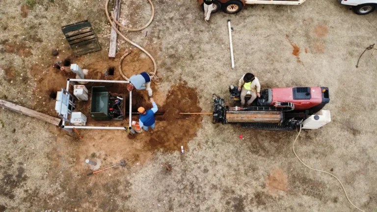
The USDA soil survey maps Sunev as the leading soil series in Valley Mills at 25 percent of the mapped area. Purves accounts for 16 percent, and Denton and Aledo each account for 11 percent. At about 40 inches below the surface, the mapped textures include loam in 27 percent of the area, silt loam in 11 percent and gravelly clay loam in 10 percent. At the surface, clay loam is mapped in 28 percent, while clay accounts for 25 percent. These are mapped patterns, not test borings, so a route near Farm Road 56 still needs site specific planning.
| USDA soil survey, inside the Valley Mills city limits | What is mapped |
|---|---|
| Soil series mapped | Sunev 25 percent, Purves 16 percent, Denton 11 percent, Aledo 11 percent and Cranfill 10 percent |
| Texture at the surface | clay loam 28 percent, gravelly clay loam 26 percent and clay 25 percent |
| Texture about 40 inches down | bedrock 33 percent, loam 27 percent and silt loam 11 percent |
| Engineering class about 40 inches down | lean clay (CL) 39 percent, fat clay (CH) 16 percent and silty gravel (GM) 10 percent |
| Average clay content about 40 inches down | 31 percent |
| Bedrock mapped within 60 inches | 44 percent of the area (40 percent hard rock, 4 percent weathered rock) |
| Seasonal water table within 60 inches | 0 percent of the area |
| Flood prone soils | 7 percent of the area |
| High corrosion risk for uncoated steel | 32 percent of the area |
The USDA soil survey maps bedrock within 60 inches across 44 percent of Valley Mills, with hard bedrock mapped in 40 percent and weathered bedrock in 4 percent. Typical mapped bedrock depth is 24 inches, so a bore may meet rock and need slower drilling or rock tooling. Seasonal water tables are not mapped within 60 inches, while flood prone soils cover 7 percent. High steel corrosion risk is mapped in 32 percent. The geologic map names the Albian Walnut Clay, made up of clay, limestone and shale, a mix that can shift drilling conditions along Texas State Highway 6.
What does it take to bore Valley Mills ground with bedrock nearby?
Sunev clay loam and the mapped Walnut Clay call for a bore plan that can handle sticky soil and possible rock. Along Texas State Highway 6, we adjust the drilling sequence to the route and what the ground shows.
- Sunev clay loam can stick to the reamer, so we use a thinner drilling fluid and staged reaming before pulling pipe along C Avenue.
- Where the Walnut Clay map points to limestone or shale, we slow the bore and choose tooling for the ground encountered near Texas State Highway 6.
- Before approaching marks along C Avenue or Texas State Highway 6, hydrovac potholing exposes each marked utility; paint locates position, not depth.
- For the 1.56 miles of unnamed drainage mapped in Valley Mills, we plan entry and exit pits on land and track the drill head from above.
What is in the way of a new line under Texas State Highway 6 in Valley Mills?
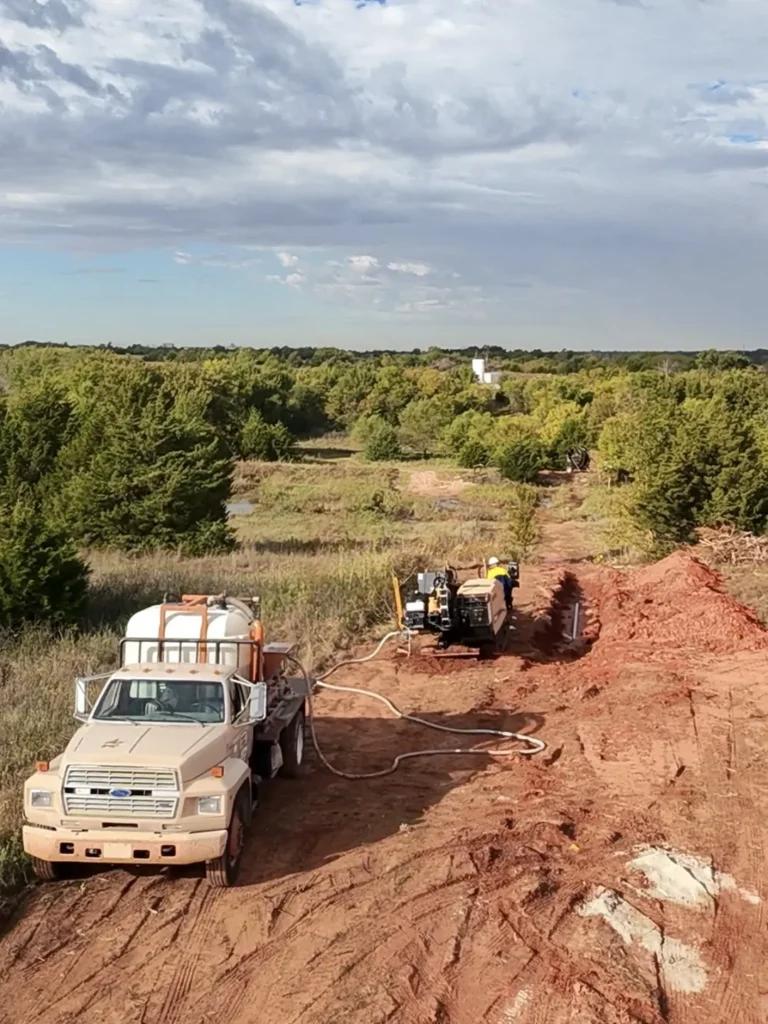
Texas State Highway 6 has 7.9 mapped roadway miles inside Valley Mills, and Texas State Highway 317 adds 0.4 miles. A line running across either state road needs a bore plan that accounts for pavement and the required cover. Patton Road is the longest named street at 1.3 miles in the city, followed by C Avenue at 0.98 miles and Farm Road 56 at 0.79 miles. Those streets offer likely utility routes, but existing lines and available work space affect where entry and exit pits can sit.
| Crossing | Type | Mapped extent | Who has a say |
|---|---|---|---|
| Texas State Highway 6 | State highway | 7.9 roadway miles inside | State highway office |
| Texas State Highway 317 | State highway | 0.4 roadway miles inside | State highway office |
| BNSF Railway | Railroad | 1 track miles inside | The railroad |
| North Bosque River | Stream nearby | Along the boundary | Checked for Corps of Engineers jurisdiction |
| Sears Creek | Stream nearby | 0.8 miles outside | Checked for Corps of Engineers jurisdiction |
| Hog Creek | Stream nearby | 0.9 miles outside | Checked for Corps of Engineers jurisdiction |
| Long Branch | Stream nearby | 0.9 miles outside | Checked for Corps of Engineers jurisdiction |
BNSF Railway has 1.0 track mile in Valley Mills on the Fort Worth Subdivision, and 4 mapped street and rail crossings make track access part of route planning. A railroad crossing needs an agreement with BNSF Railway that sets its crossing details. No streams are mapped inside the city limits, but the North Bosque River runs along or touches the boundary; Sears Creek is 0.8 miles away. One street crossing of a named stream is mapped in the city, and the area has 1.56 miles of unnamed drainage. No lakes or ponds are mapped within one mile.
Who approves a bore on Valley Mills streets in Bosque County?
Valley Mills is an incorporated city, so its city streets belong to the city itself; no city department, fee or form is specified here. For work in the right of way of Texas State Highway 6, Texas State Highway 317 or Farm Road 56, the utility owner applies for a TxDOT utility permit through RULIS. The TxDOT Waco District reviews it, and we prepare the bore plan and profile for the utility owner to submit. Highway cover and pavement rules shape the bore design. A crossing of BNSF Railway needs an agreement with the railroad, and a North Bosque River crossing is checked for federal jurisdiction during planning.
Read the rules for yourself: Texas Utilities Code Chapter 251 on notice to Texas811, the Texas811 questions and answers page, the TxDOT Utility Accommodation Rules, 43 TAC 21.40 and TxDOT utility permits in RULIS.
Who owns the water lines in Valley Mills for the City of Valley Mills?
The City of Valley Mills public water system uses groundwater wells and reports 582 service connections serving 1,203 people. Before a water bore near C Avenue, hydrovac potholing can expose marked lines and show their depth. Electric providers reporting service in Bosque County include Oncor Electric Delivery Company, Texas-New Mexico Power, Heart of Texas Electric Cooperative and United Electric Cooperative Service. We confirm the line owner before planning an electric conduit bore, since those providers do not each serve every address.
| Line owner | What it is | Source | Size |
|---|---|---|---|
| City of Valley Mills | Public water system | Groundwater wells | 582 connections, 1,203 people served |
| Oncor Electric Delivery Company, Texas-New Mexico Power, Heart of Texas Electric Cooperative and United Electric Cooperative Service | Electric utilities reporting service in Bosque County and McLennan County | EIA Form 861 | Confirm the line owner by address |
The American Community Survey 2019 to 2023 five year estimates put Valley Mills’ median housing year at 1959; 52 percent of housing was built before 1960, and 6 percent was built in 2000 or later. A replacement route along C Avenue may meet older buried lines, while a new service near Farm Road 56 still needs its path checked. We hydrovac pothole marked utilities before the drill approaches, because surface marks show position but not depth.
Where is Valley Mills in relation to McGregor and nearby towns?
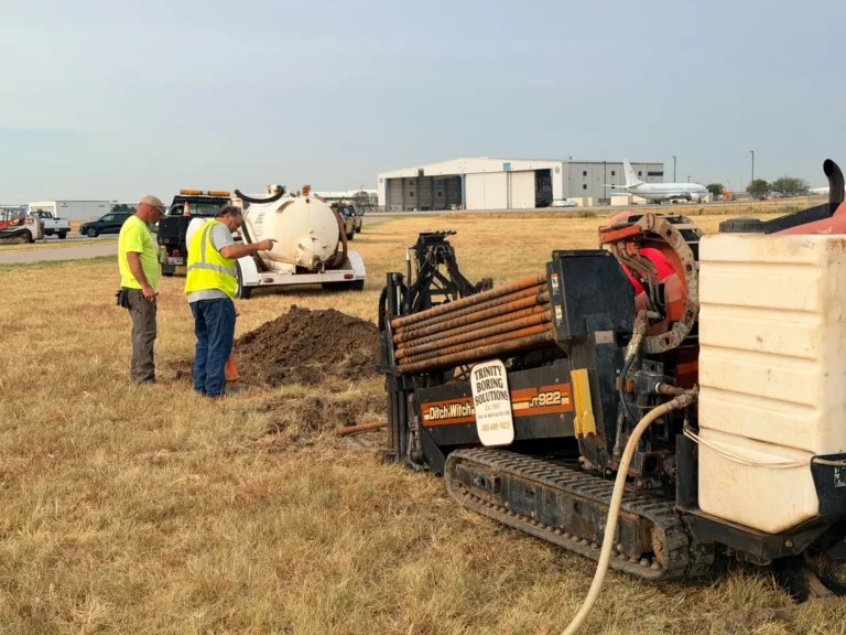
Valley Mills spans Bosque County and McLennan County in central Texas, at an elevation of 610 feet and over 1.22 square miles. The city uses ZIP code 76689. Mosheim is 7.7 miles west, Crawford is 8.4 miles south, China Spring is 9.9 miles east, and Clifton is 10.8 miles northwest. McGregor, the nearest larger city, is 16.6 miles south; Meridian, the Bosque County seat, is 21.3 miles northwest. From our Yukon yard, the road trip to Valley Mills is 305 miles and 6.2 hours, which matters when setting up a distant job.
Places near Valley Mills
- Directional boring in Mosheim: 7.7 miles west
- Directional boring in Crawford: 8.4 miles south
- Directional boring in China Spring: 9.9 miles east
- Directional boring in Clifton: 10.8 miles northwest
- Directional boring in Willow Grove: 12.4 miles southeast
- Directional boring in McGregor: 16.6 miles south
What kinds of bores come up near Farm Road 56 in Valley Mills?
- Highway crossing: A bore beneath Texas State Highway 6 keeps the pavement intact and follows the cover and crossing conditions in the TxDOT permit.
- Water service: A new line near the City of Valley Mills system needs its route checked against groundwater connections and other buried utilities.
- Fiber route: A conduit bore along C Avenue can pass beneath the street surface, with marked lines pothole exposed before drilling approaches.
- Rail crossing: A route under the BNSF Railway Fort Worth Subdivision needs the railroad’s crossing agreement and its requirements for the work.
- Drainage crossing: A bore near the North Bosque River boundary needs channel depth and jurisdiction considered during planning.
- Farm service: A line near Farm Road 56 can use directional boring to cross the road without cutting its pavement.
More on each kind of work: water line boring, electric line boring, fiber optic boring, road, railroad and creek crossings and municipal boring.
How do I get a quote for a bore near Patton Road in Valley Mills?
For a bore near Patton Road or the BNSF track, send the address or map pin, what is going in the ground, pipe or conduit size, footage, and any sketch or plans. A plan showing the Texas State Highway 6, C Avenue or creek approaches helps us see crossings and work room before we set the scope.
For a route near Sunev clay loam, soil and rock conditions matter first because they affect drilling speed and the reaming plan. Next, the number of utilities to expose and crossings of Texas State Highway 6 or BNSF Railway can change the work. Pavement, drainage, pit space, backfill and excavator time also count. Pipe size and bore length shape the equipment needed, while the 305 road miles from Yukon affect mobilization. We set the quote from those job details, not from a single local rate.
Questions people ask about boring in Valley Mills
Does Trinity Boring Solutions take jobs in Bosque County near Valley Mills, and who staffs them?
Yes. We take directional boring work in Valley Mills and Bosque County, with our own crews and crews from partner drilling contractors we have vetted. You work with Trinity from the first call through the bore log, regardless of which crew is on site near C Avenue or Texas State Highway 6.
How do older homes and buried lines near C Avenue affect Valley Mills replacement bores?
The American Community Survey 2019 to 2023 five year estimates give Valley Mills a median housing year of 1959, with 52 percent of homes built before 1960. A replacement bore near C Avenue may encounter older utilities, so marked lines are exposed with hydrovac potholing before the drill gets close.
Does Sunev soil create a steel corrosion concern for Valley Mills bores, and what pipe can be used?
The USDA soil survey maps high steel corrosion risk in 32 percent of Valley Mills, so the line owner chooses any coating for steel casing or tracer wire. HDPE is another pipe option and is not subject to that soil corrosion concern. The Sunev mapping describes soil patterns, not conditions verified at a particular C Avenue address.
What ground should I expect for a bore through Sunev soil in Valley Mills?
The USDA soil survey maps Sunev across 25 percent of Valley Mills, with clay loam the most common surface texture at 28 percent. At about 40 inches, mapped textures include loam and silt loam, while bedrock appears in 33 percent of the area. Those patterns help plan a bore near Farm Road 56, but they are not test borings.
Will a Valley Mills bore encounter rock, and how much bedrock is mapped within five feet?
Rock is a real possibility: the USDA soil survey maps bedrock within 60 inches across 44 percent of Valley Mills. Hard bedrock is mapped in 40 percent and weathered bedrock in 4 percent. Near Texas State Highway 6, the route and encountered ground determine whether we need rock tooling or a slower drilling sequence.
Who permits a Valley Mills bore beneath Texas State Highway 6?
The utility owner applies for the TxDOT utility permit in RULIS, and the TxDOT Waco District reviews work in the right of way of Texas State Highway 6. We prepare the bore plan and profile for the filing. The permit sets the approved crossing conditions, including cover and installation requirements.
Does Trinity cover Valley Mills, Mosheim and rural sites outside the city?
Yes. We take work in Valley Mills, nearby Mosheim and rural locations outside the city limits. The route still determines the details: a bore near Texas State Highway 6 involves state right of way rules, while a rural line may have different utility crossings and access needs.
How much notice does Texas811 need for a bore near Patton Road in Valley Mills?
Count back at least two working days, or 48 hours excluding Saturdays, Sundays and legal holidays, from the planned start near Patton Road. The notice cannot be made earlier than 14 days before excavation. If the start slips more than 14 days past the original notice, make a new request; refresh worn or moved marks through Texas811 before work continues.
What affects the cost of directional boring near Texas State Highway 6 in Valley Mills?
The price depends on the route and scope. Sunev clay loam and possible bedrock affect drilling time, while Texas State Highway 6, BNSF Railway and marked utilities add crossing work. Pipe size, bore length, pavement, drainage, pits and backfill also matter. Mobilization is affected by the 305 road miles from our Yukon yard.
Where the Valley Mills facts on this page come from
- USDA Natural Resources Conservation Service, Soil Data Access: soil survey map units inside Valley Mills
- U.S. Census Bureau, TIGER/Line 2024: Valley Mills boundary, roads, rail lines and streams
- U.S. Census Bureau, Vintage 2024 population estimates: Valley Mills
- U.S. Census Bureau, American Community Survey 2019 to 2023: Valley Mills housing units and year built
- Macrostrat geologic map compilation: map units under Valley Mills
- U.S. EPA Safe Drinking Water Information System: public water systems serving Valley Mills
- U.S. Department of Transportation, North American Rail Network: track owners in Bosque County and McLennan County
- U.S. Energy Information Administration, Form EIA 861: electric utilities serving Bosque County and McLennan County
- U.S. Geological Survey, Elevation Point Query Service: Valley Mills elevation
- OpenStreetMap road network through the OSRM router: road miles from Yukon, Oklahoma to Valley Mills
- Texas Utilities Code Chapter 251, Underground Facility Damage Prevention and Safety
- TxDOT Utility Accommodation Rules, 43 Tex. Admin. Code 21.40: underground utilities
- Texas Department of Transportation: Right of Way Utility and Leasing Information System (RULIS) utility permits
About Trinity Boring Solutions
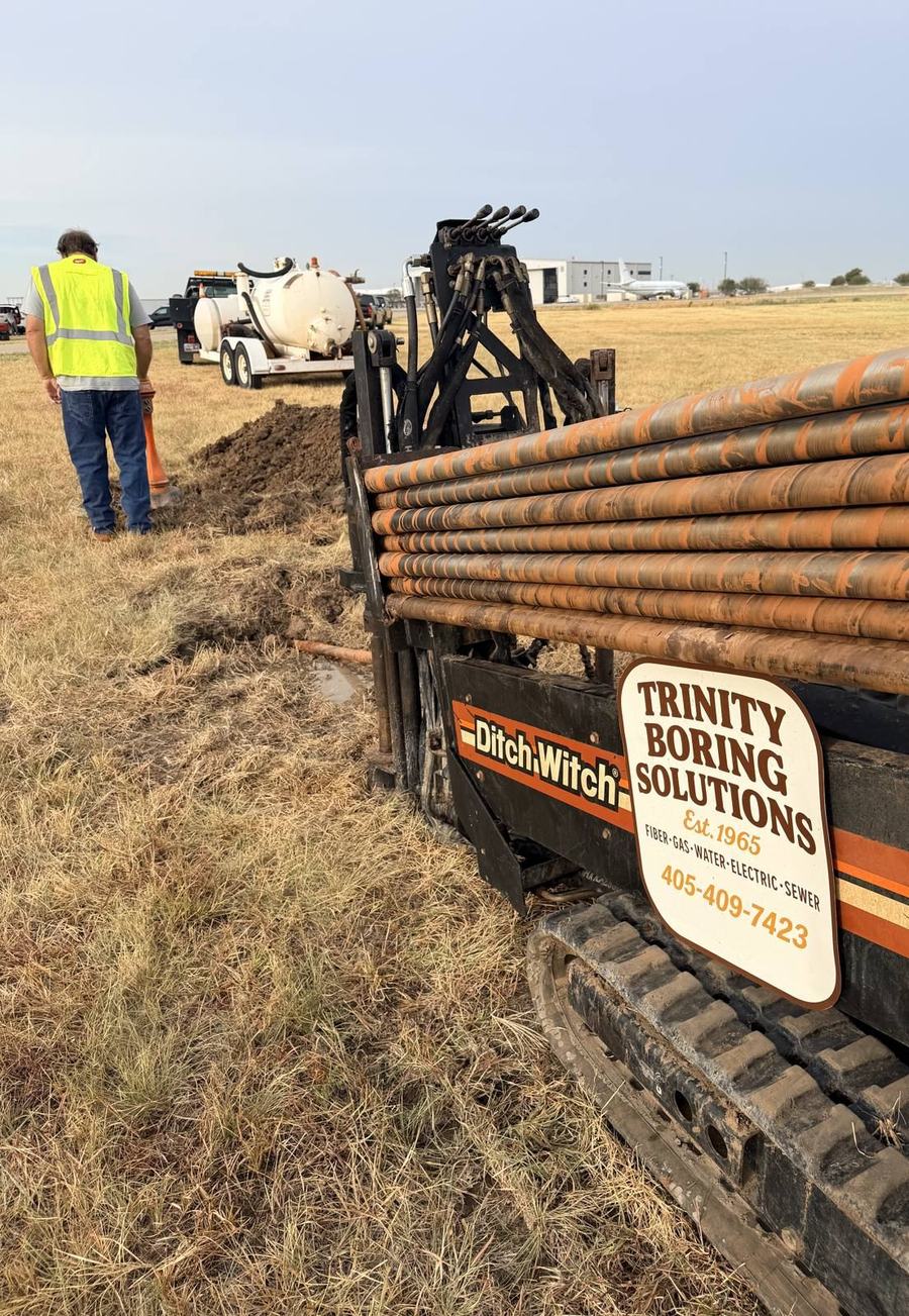
Trinity Boring Solutions is a family business in Yukon, Oklahoma, founded by Dean Rice in 1965 and owned today by Darren Rice, who started its directional boring side in 1982. The company bores across Oklahoma and Texas. No bore is too big or too small: 4 foot sidewalk sleeves to roughly 4,100 feet under the Arkansas River in Tulsa. Reach us at (405) 409-7423.
Get a Quote for a Bore in Valley Mills
Send the address, what is going in, the size and the footage.
Trinity Boring Solutions
9102 NW Expressway, Yukon, OK 73099
(405) 409-7423 | darren@trinityboringsolutions.com
Free Bore Planner
Plan Your Bore in Valley Mills, Texas
Type the address of your job in Valley Mills. The Bore Planner opens an aerial map at that spot. Drop one pin where the bore starts and one where it ends, tell us what is going in and send the scope to our crew.
Talk to the crew that does the work
Fastest way to a number is a phone call. Tell us where the crossing is and what is going in the ground, and you will get a straight answer on the same call. Bores from 10 feet to 5,000 feet, 3/4 inch service line through 48 inch casing, anywhere in Oklahoma and Texas. We run 24/7 for main breaks and emergency repairs.
Answered by a person, not a call center.
Would rather not call? Send the details and we will come back with a written quote.
County and State Pages for Valley Mills
Same county: Meridian · Laguna Park · Walnut Springs · Morgan · Iredell · Cranfills Gap · Kopperl. All counties: Texas county list.